
SUNDAY 15 AUGUST DALHOUSIE SPRINGS TO PURNI BORE 75kms
We were up at 7.30. It was a day with blue sky but was not hot.
Left Dalhousie at 9.30am.
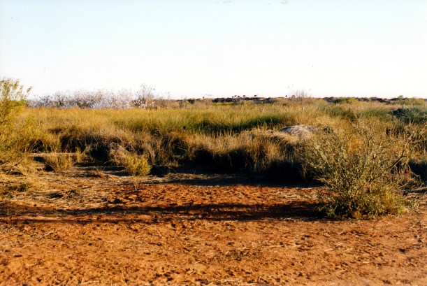
The country we passed through today varied a little. We had claypan bog areas to begin with – the claypan Spring Creek delta, with the evocatively named Gluepot Bog. There was some sandy plain country, stony in parts. There were the occasional jump ups, just to be different. It was not really hard to drive.
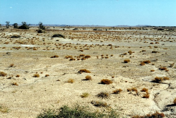
Spring Creek Delta and extinct Dalhousie mound springs

The Gluepot Bog
Not far from Dalhousie, there was a dingo beside the track. He was quite a big one. We were able to get quite close to him, for photos.

One of the locals – good looking dingo near Dalhousie Springs
We trended north east across the flood-out country for much of the way.
At Freeth Junction, where the closed Macumba track comes in from the south, there was a display board with emergency contact details, and instructions for radio use. Here, we really began to feel isolated.
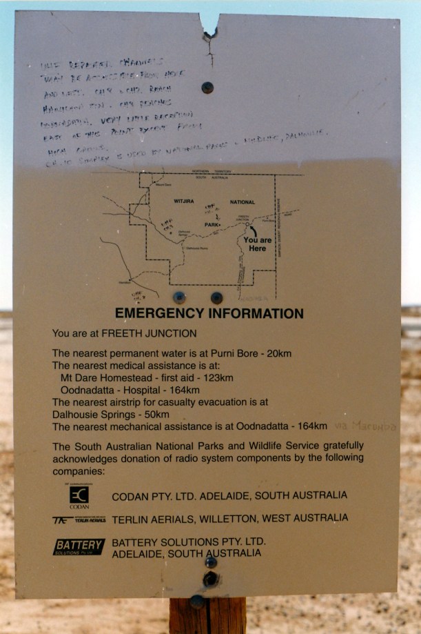
Sign at Freeth Junction
It is around Freeth Junction that the Finke River disappears into a salt pan in the Simpson Desert.
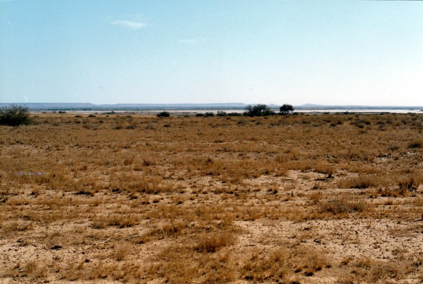
The ancient Finke River ends in a salt pan near Freeth Junction
We used the HF rdio to phone K, from here. It was a clear call, for once. He confirmed that he had received our instructions and understands the seriousness of reporting to authorities, if we have not contacted him by the date specified. He is our safety net, along with the trip plans we’d left with Alice Springs Base.
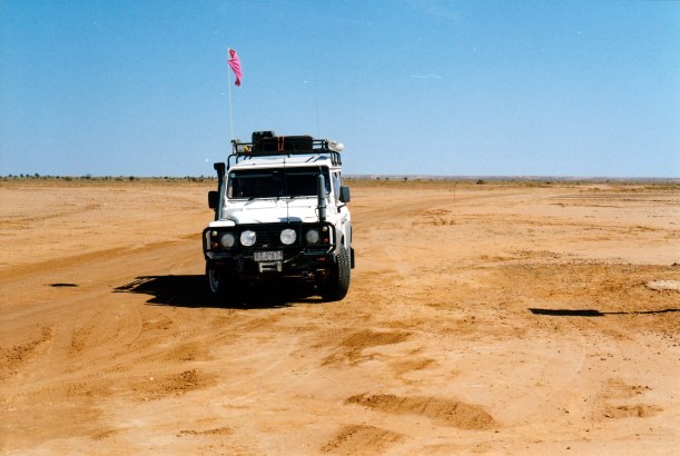
At Freeth Junction. The track we came in on trends to the upper right of the photo
Beyond Freeth Junction, sand dune country gradually began. By the time we reached Purni Bore, were definitely in dune country.
The long parallel dunes of the Simpson extend in a general NW-SE line. There are over 1100 dunes from Birdsville, stretching up towards Alice Springs. Some are 200kms along. It is the largest sand dune desert in the world. Before finding out more about the place, I had envisaged something like the Sahara, but the Simpson dunes are vegetated enough to be, largely, fixed in position.
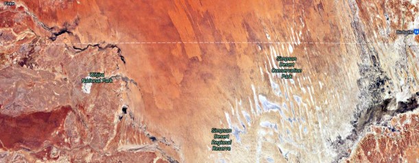
What the Simpson Desert looks like from space
We do not have to cross all 1100 dunes, as some only begin to the north of here. But we will tackle several hundred of the things. I will not be counting! Going the way we are, we start with the lowest dunes – maybe 3 metres or so – and gradually build up to the bigger ones in the east, around30 metres high. By then, we will have had plenty of practice at climbing dunes. Also, going this way, we will be going up the less steep side of each dune. They have been shaped by westerly winds, so the east side is the more steep drop-off side.
The tracks that we will be following now, were put in by companies exploring for oil and gas in the 1960’s and 70’s, and sinking wells. Reg Sprigg – of Arkaroola fame – surveyed the first seismic line across; this became known as the French line, because the French Petroleum Company did the first geological survey along this. Essentially, it runs in a broadly straight line from Purni to the Qld-SA-NT border at Poeppel Corner. It is the route most commonly taken by Simpson travellers, partly because it is the shortest, partly because of its reputation for challenging dunes.
We planned to be different and take a more roundabout route. This would enable us to see more of the Desert, hopefully for some of the time be away from the more popular parts, and also be somewhat easier, as for some of the way we would follow the Rig Road. This route was developed to service oil and gas operations; it was graded and clay capped, to be able to carry trucks. Much of this has broken down in the years since it was used, and it is 4WD only, now.
As well, our route would take in some N-S tracks, in between the parallel dunes, rather than always going across them as the French Line does. We still will have to cross the things, but the inter-dune tracks will provide variety.
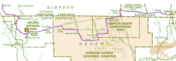
Our planned route across the Simpson Desert
I was expecting that there would be more travellers on this first part of the way, where we are on the French Line route, and the more popular E to W way. But it was a surprise that in the 75kms from Dalhousie to Purni, we passed only three vehicles coming towards us.
We were the first to set up camp at Purni Bore – another surprise. So we were able to pick a spot where there were some low bushes around us. The camp area here was not dusty like Dalhousie was.

Our camp at Purni Bore
While we were setting up the tent, several vehicles from a Melbourne 4WD club came and set up nearby – guess we must have picked the most attractive part of this fairly extensive area! Later, another four vehicles arrived. One lot, with children, camped right behind us, despite there being lots of other space around! There are times that I hate other travellers….. At least, the group with the feral kids, from Dalhousie, did not appear – we had dreaded them tagging us this far.
Purni was beautiful, in a surreal way. The water from the bore is so hot that it steams for a while after it runs into the pool area. Dante’s Inferno came to mind.
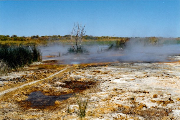
The steaming outflow water at Purni Bore
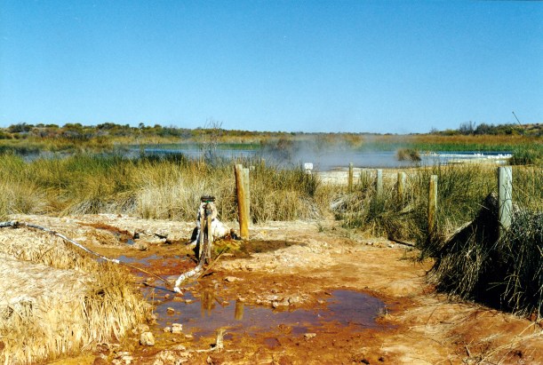
The bore at Purni
There are no pools to swim in, here. The water is too hot and too polluted by feral camels and donkeys. But there is a hot shower and a laundry tub with hot water, along with the long drop toilet. It is all kind of anachronistic amongst the dunes.
There were lots of birds – water birds, bush birds and hundreds of corellas clustered in one area of trees. We spotted crimson chats – hadn’t see those before.

Purni wetlands and emus
After camp was set up and lunch was had, we walked around the perimeter of the wetland area. Like at Coward Springs, this is here because of the bore outflow. Purni Bore has been capped, in recent times, to limit the outflow, so the wetland is not as extensive as it once would have been.
On our walk, saw a mob of about eight camels. Later, near sunset time, these appeared on the dune skyline.
The extra vegetation, and the water, attracts camels
We wanted a photo of the corellas rising from the trees, so John walked around that way to see if some would take flight. He made a noise and there was a mass takeoff. It was a pity I couldn’t capture the very loud and raucous noise they made, as well as the image! It gave John quite a fright.
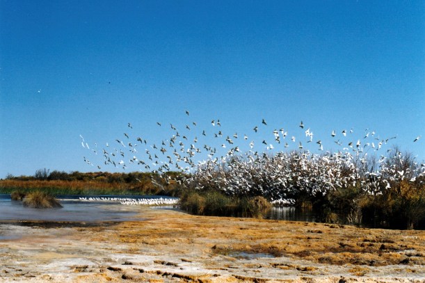
Corellas taking fright
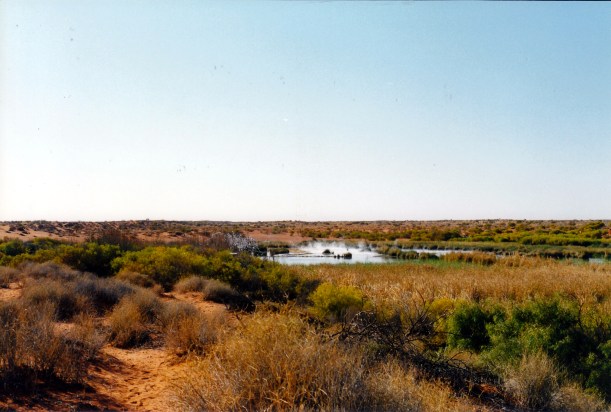
Looking over the Purni wetlands to the camp area, ar right
By the time I’d gotten things organized for tea, there was a queue at the shower, so I gave up on that, because we did not want a late tea. Then John got fiddling with the GPS and didn’t want to stop, so tea was late after all!
We ate tinned soup, a stew made from chick peas, kumara, spinach and tomatoes. So tea used quite a few tins and we lightened the load in Truck.
After tea, went and sat round the campfire (bonfire!) of the 4WD club. Talked with them. They had, between them, had a lot of varied experiences. They had just come from the Canning Stock Route – a trip that took them two years to plan. They seem very well organized. It was a pleasant, convivial evening, if somewhat cold.
The fridge did not work again, this afternoon, so we have finally given up on it.
