This Adventurous Age

Adventures travelling and working around Australia.


Leave a comment

1999 Travels June 15

TUESDAY 15 JUNE     KINGS CANYON

Another sunny, superb day.

We decided to tackle this end of the Ernest Giles Track. John was feeling up to it. For once, we managed to get a reasonably early start.

Drove to the Kings Canyon carpark. The first part of the walk is up the “down” part of the Canyon Rim walk track, for about a km. Then our track branched off to the right.

06-15-1999 01 from tk up view across to Giles Tk.jpg

That is where we are going – taken from the Rim Track

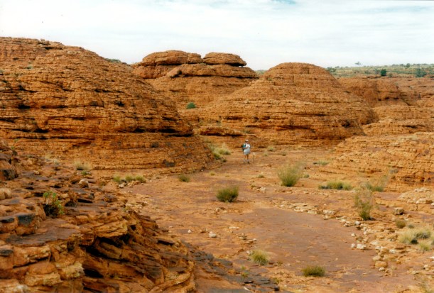
The track went through absolutely brilliant dome terrain, for about 3kms. This was even better than the similar country encountered on the Canyon Rim walk. The domes just seemed to go on and on. The track wound around between them. In places, it went along little ledges, with quite a drop below.

06-15-1999 02 lost city domes.jpg

The track can be seen, winding through the domes

06-15-1999 03 on Giles Track in domes.jpg

The track was clearly marked

06-15-1999 04 giles track in domes.jpg

Erosion into the side of a dome

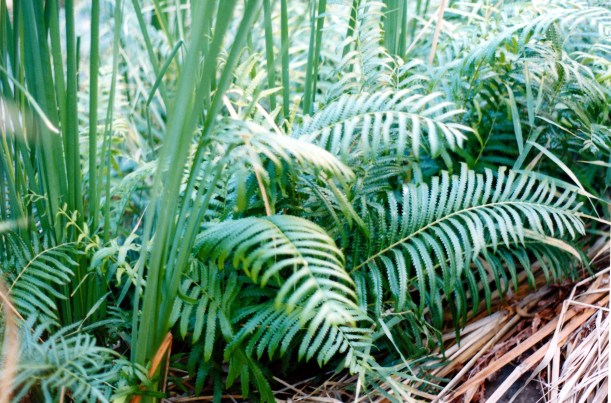
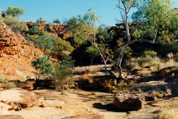
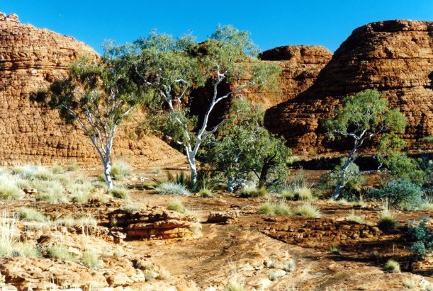
The red sandstone of the domes was broken up by little ravines in which ghost gums and shrubbery grew, providing green contrast.

06-15-1999 05 domes on giles tk.jpg

Little ravines provide shelter and moisture for trees and shrubs

I could have spent all day in this dome section – and used up a ton of film!

We emerged out onto a flatter section of the plateau, into shrub and spinifex country.

Walked as far as the 6.5km point. We had intended to have lunch at Penny Springs, shown on the rather vague track guide we had. But somehow missed these. Decided they must be lower down and off the main track. We certainly did not see any sign – or a viable side track.

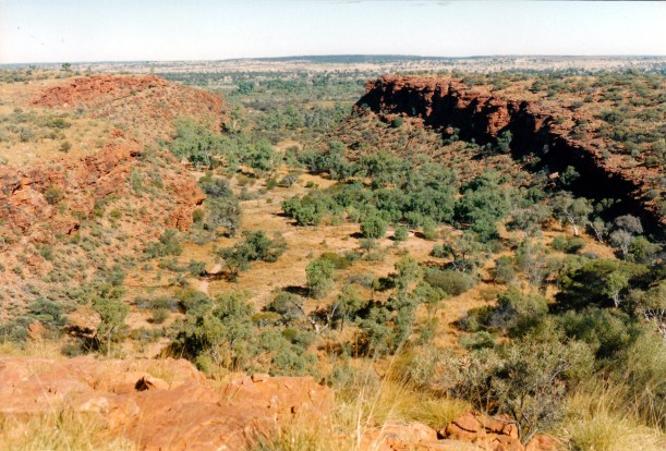
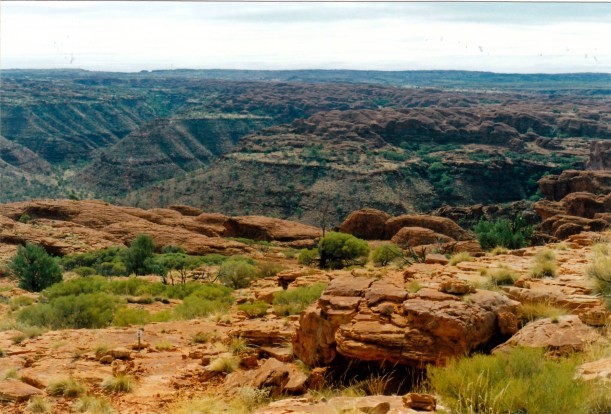
Instead, we lunched at a high point near Reedy Bluff, where we could see out over the plains, and also behind us to more range country. That looks pretty interesting, too. I can believe the Resort staff who told us they have been shown places “out the back” that are even better than Kings Canyon! Hmmm – maybe this would be a more interesting place to work than Yulara? But, being much smaller, there would not be as many job openings – or the mod cons of Yulara.

06-15-1999 08 Kings Canyon Resort from edge of range.jpg

The outlook from the track onto the plains. The Resort is in the centre of photo

06-15-1999 09 watarrka lo and rim tks

Outlook from Watarrka Lookout, showing the canton entrances

06-15-1999 10 the domes beyond Kings Canyon

From Watarrka Lookout showing the domes and the country beyond

This top country was open and a bit hot from the high afternoon sun.

We came across some unusual small rock features – other than domes! The sediments that eventually formed these sandstones were originally deposited under inland lakes. In one place we found the solidified remnants of what looked like the leavings of some aquatic snail or crab.

06-15-1999 11 Giles Tk interesting rock.jpg

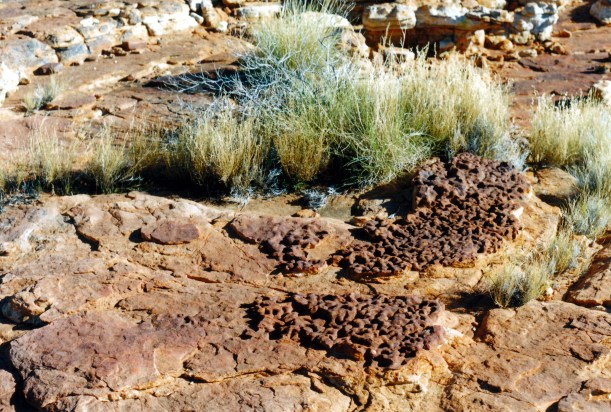
Unusual and suggestive rock

In another place, erosion had created an ultra small scale version of domes.

06-15-1999 14 Giles Tk rock patterns.jpg

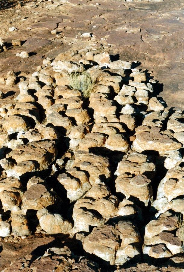
Tiny domes. The grass clump gives an idea of scale

John’s hip was hurting by the time we stopped for lunch. He’d had a scheme for walking on to the Lilla Spur and following that down, then going back to the car park on tracks that paralleled the main road. But I felt this would be too far – I calculated somewhere around 16+kms, whereas we had walked almost 7kms to where we were. John agreed – reluctantly – to retrace our steps, though he toyed with the idea of trying to go straight down the escarpment from Reedy Bluff. I would not agree to that – really prefer not to do mountain goat if I can help it.

I really enjoyed the walk back through the domes – the afternoon light was superb.

06-15-1999 13 Giles Tk ghost gums.jpg

Back in the domes section of the Giles Track

Part-way down the main Rim Track to the car park, we met a lady resting on her way up. She was a professional photographer (Bette Devine) going up to the top to get sunset shots. We told her about the domes we’d been through today. After some chat, it was discovered that she had taught at a suburban primary school with John, years ago. They had not gotten on too well then! She has a camper van and travels on her own, taking photos. What an interesting life style! I would have liked to talk photography with her, but John talked school stuff with her, and then it was time to move on.

06-15-1999 15 corner Giles and Rim tracks.jpg

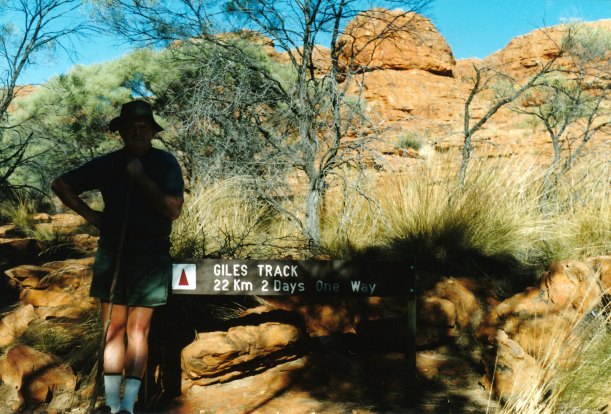
The corner of the Rim Track and the Giles Track

We walked about 14kms today – and it was excellent.

At the Resort, refuelled Truck – $1 a litre. Ouch.

Tea was rissoles and mashed potato.

We packed up as much as we could.

I am so glad that we made the effort to come this way – has been a wonderful place to experience, and one that I will long remember.


Leave a comment

1999 Travels June 13

MONDAY 13 JUNE     KINGS CANYON

Today is my brother’s 50th birthday. I wonder what he feels about attaining this landmark?

The day dawned sunny, so we took a packed lunch and drove to the Kathleen Springs area – back eastwards some 23kms from the campground.

Kathleen Springs is, as the name suggests, an area where permanent water derived from springs, is found. Such a place, in this arid environment, was of great importance for wild life, aborigines and later, pastoralists.

06-13-1999 01 in spinifex ring.jpg

Perfect spinifex ring at Kathleen Springs

We walked the 1.3kms track to the Springs, looking at birds, and at the remnants of the pastoral industry: trapping yards, windmill site, and tank. The trapping yards were built in the early 60’s. As a natural valley, where cattle came to get water, it was an obvious point for catching cattle to send off to market.

06-13-1999 02 yards kathleen springs

Old cattle loading ramp at the trapping yards – note fence up gully side

06-13-1999 03 old fence Kathleen Springs

Cattle trapping fence at Kathleen Springs

It was a very pleasant walk, where we saw few other people. Quite a contrast to the main part of the Kings Canyon.

The springs themselves, and associated pool seemed rather dark and sombre. A creeping fern grows there that is found nowhere else in the world.

06-13-1999 04 creeping fern unique to Kathleen Springs.jpg

Kathleen Springs Creeping Fern

We walked back to the picnic area near the car park and ate lunch. Saw some spinifex pigeons on the way back to the picnic area, and watched them for a while. They are superbly camouflaged.

06-13-1999 06  Kathleen Ck valley where yards are.jpg

The Kathleen Springs valley – easy to see why it was a great place to catch cattle

After lunch, walked up the Giles Track. This is a 22km long track between Kathleen Springs car park and Kings Canyon. It roughly follows the edge of the plateau that is the George Gill Range. Track notes recommend an overnight camp somewhere along its length, but I suppose it could be done as a long day walk, if one did not spend too much time looking around. However, we do not have the requisite transport at each end, so plan to walk some of each end of it.

After the track climbed over some ridge tops, we got a good view back over Kathleen Springs canyon and the area of the trapping yards.

This was a very pleasant walk – not very hard – through varied country. We saw no other walkers.

I saw a strange plant – rather like a cross between cacti and broome – not sure if it is a native to the area, or a weed.

After about 4kms, we reached the Wanga Creek valley – mostly dry – and explored down the creek to where it drops precipitously off the escarpment. It was quite a deep and rugged little valley at this point. There were a few small waterholes. It was a lovely, peaceful place.

06-13-1999 07 Wanga Ck view downstream

The Wanga Creek valley

06-13-1999 08 exploring Wanga Ck.jpg

Scrambling down the Wanga Creek valley – dry waterfall

06-13-1999 10 wanga creek.jpg

The point at which the Wanga Creek drops over the edge of the plateau

It occurred to us that, when there is rain in these parts, there would be a number of waterfalls coming over the edge of the plateau – and over the walls of Kings Canyon, too. It could be a really interesting time to visit.


In our exploring, rather lost track of time, and finished up having to do a fast walk of the 4kms back to Truck. Reached there about 5.30pm.

06-13-1999 wanga ck upstream.jpg

Late afternoon at Wanga Creek

Back at camp, showered, then made tea of potato soup, crab and corn cakes – using tinned crab meat.