This Adventurous Age

Adventures travelling and working around Australia.


Leave a comment

2000 Travels August 5

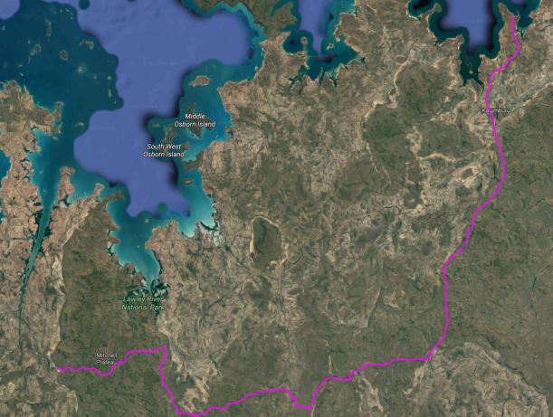
SATURDAY 5 AUGUST   HONEYMOON BEACH TO MITCHELL PLATEAU   229kms

We were woken early by campground noises and so were up at 6.15am.

There was water, so I was able to have a shower and wash my hair, which made me feel much better.

We worked steadily on the pack up and left about 8.40, after stopping off at the shed/office to say goodbye. Les and R had already gone out on the boat with a fishing party, so we only saw his wife and daughter.

Today’s was another mass exodus. By the time we left, there was only one remaining group.

After yesterday, it felt good to be going. Apparently, there was to be a corroboree and a celebration for the Sisters – some sort of anniversary – in town tonight, and we could have gone to that. It might have been interesting.  But we hadn’t found out about it until we were packed up, and by then we were very focussed on going.

The driving was alright – it seemed ages since we had done that!

Not far from town, drove past burning bush, not far from the road. We assumed it was the normal dry season burning, done by the locals, to deter fierce fires later in the season, by reducing fuel availability, in an ad hoc sort of pattern.

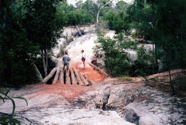
The road condition was rather varied. THE problem creek crossing had been worked on and partly filled in. A pile of earth covered where the rock had been, and a big stick marked the way. Road repairs Kalumburu style!

08-05-2000 01 rock fixed.jpg

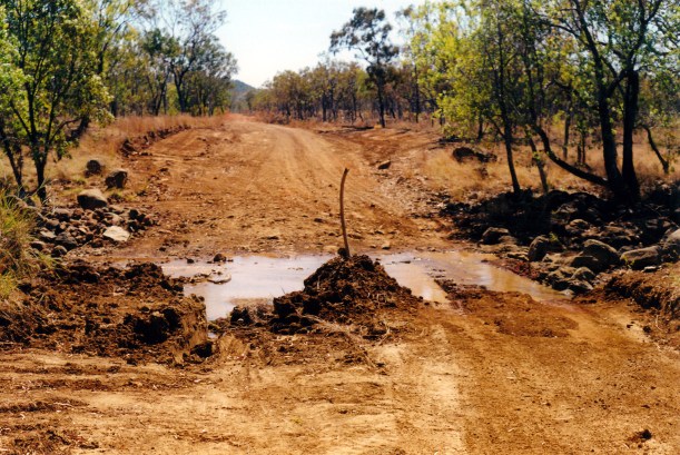
Road repairs! The problem rock dealt with, and much less water.

We called in at Theda Station, briefly. I bought grapefruit, some used books that were for sale, and a postcard.

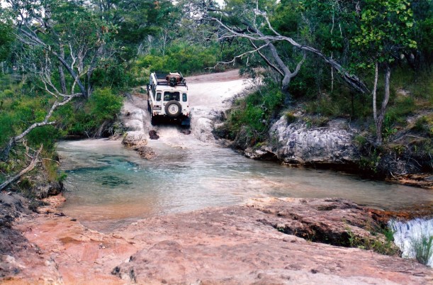
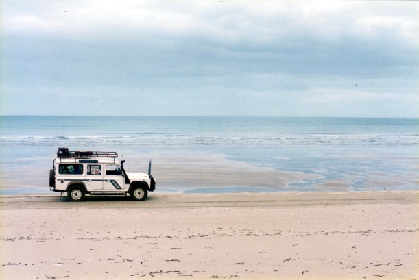
Next stop was at the King Edward River, for lunch. We had to ford the river to reach the camp ground and stopping place beside the river. The ford was 40-50cms deep and quite rough, though not all that wide.

The area was most picturesque and we would both really like to spend some time camped there, so we decided to do that after we’d been to the Mitchell Plateau.

08-05-2000 02 King Edward River.jpg

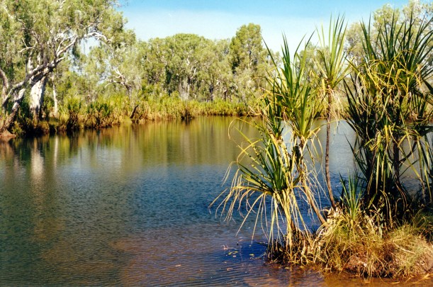
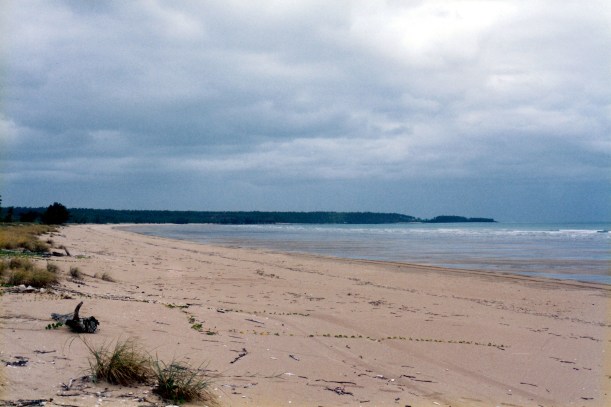
King Edward River near the camping area

After lunch, found where D and R were camped, and exchanged home addresses, which we’d forgotten to do at Honeymoon.

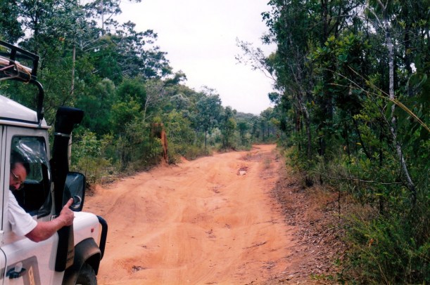
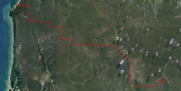
It took us two hours to drive from the King Edward River to the Mitchell Falls camp area – 85kms. The track was corrugated, stony, rough, winding, and needed much concentration. Hazards such as sharp corners were not signposted. The road camber was wrong in parts too.

For some of the way, the track followed a ridge line, and there were some distant views out across the scrubland. After some 60kms, we came to the small, but boggy crossing of Camp Creek. On our ’93 trip, we’d camped a little distance from the Mitchell Plateau track, beside Camp Creek. The area looked different from what we remembered, and I thought the track route may have slightly changed. Back then ,there was a rather confusing maze of tracks around here. From there, we’d gone to Crystal Creek, the most northerly spot on the Plateau able to be reached by vehicle. We had not turned off the Port Warrender track to go to Mitchell Falls, which were hardly flowing that year. This time, only a couple of kms beyond Camp Creek, we turned left for the Falls. So, the 15kms of the track to the Falls camp are was new for us.

There had recently been a big fire through some of that country – it was quite desolate in parts.

08-05-2000 03 Mitchell plateau burnt Livistonia palms.jpg

Burnt Livistona Palms by the track to the Mitchell Plateau

It was just after 3pm when we reached the campground. It was a hot day, but the travel had created a bit of a breeze through the windows.

The camp area was bigger than I expected and not as crowded as I’d feared. However, it was rather barren, rocky and hot, but would do for our purpose of a place to camp whilst visiting the Falls. There were a few composting toilets. At least, it was free to stay here.

We had passed a number of vehicles going out as we were coming in – obviously some people do it as a day trip from King Edward River. It would be a hard day, driving that road twice, not to mention the walk to the Falls – 3kms each way.

We set up the small tent, easily enough.

08-05-2000 04 mitchell plateau camp.jpg

Camp at the Mitchell Falls campground

After setting up, we walked to the creek to get water and then up to the pilots’ base to enquire about helicopter flight options and costs. Found out that there are currently three helicopters based here. We decided to buy a 12 minute flight from the Falls back to camp, as an anniversary present to ourselves. It would cost $100 each, or $60 if they get another two passengers.

Three years ago, to this day, John went into hospital for his hip operation. That was one anniversary. The other is our wedding one, coming up in five days.

Tea was tinned ham, potato, some salad.

At night, there was a feeling of some coolness in the air.

08-05-2000 to m plat.JPG


Leave a comment

1998 Travels July 31

FRIDAY 31 JULY   ELIOT FALLS CAMP TO VRILYA POINT CAMP   83kms

It was a hot and humid morning.

After packing up, we walked back to the falls for a final swim – don’t know when we will get a swimming chance again.

Once back on the OTL Track, almost immediately we had to negotiate Canal Creek – upstream from the falls where we’d been swimming. It was very rough and with substantially deep potholes in it. We could see two options for crossing, and chose the most upstream one – considering it to have the fewest nasties to negotiate. But there were still a couple of deep holes where the exhaust was under water and blowing bubbles. Then, the exit was deeply eroded and gullied, and not really passable, so we rolled back to the creek edge where we found that an alternative exit had been made – and not too long ago, it seemed.

This section of the OTL was really badly eroded, bumpy and rough, and showing places where previous travellers had gotten bogged when it was wet. Driving terrain like this is really slow going.

Then Sam Creek was another difficult crossing – in a gully, with a rock in the middle, and deep holes. The crossing was just on the edge of a waterfall, with a long drop from the ledge, so there was limited room to manoeuvre. Again, the exhaust blew bubbles. And, again, the exit was badly channelled. Previous travellers had put boulders in the gullies to assist.

07-31-1998 02 Sam Ck pristine.jpg

Sam Creek – looks rather deceptively easy

07-31-1998-03-sam-creek

Truck blowing bubbles in the deeper hole

07-31-1998-04-sam-ck-exit

Up and out

We were getting sick of all the difficult creek crossings at this stage. John had decided that he really wanted to go and camp at Vrilya Point. The only sensible way now to get to that was to cut across to the Northern Bypass Road on a track that followed the ridge between Sam and Mistake Creeks. This would mean that we missed the somewhat notorious crossing of Cannibal Creek and the others with washed-out “bridges” that we had heard about. No thanks – I didn’t want to tackle those, anyway! We had even passed a sign warning that ahead was a  “Bridge Under Repair”  – a bad omen on a track that otherwise has no signs.

So we turned west onto the linking track for a few kms, then right onto the Bypass Road. Found the turn off for Vrilya Point, to the west, with no problems. It is definitely a 4WD road!

07-31-1998-01-otl-track

This section of the  Bypass Road is slow going, too.

What did I say about not tackling makeshift bridge crossings? A few kms along this track, we came to a truly tricky – and scary – crossing of Crystal Creek. It is bridged. The “bridge” spans a deep and narrow gully, with major erosion gullies down the sides of the approaches to the bridge. Logs had been cut to span the gully, but these appeared to have shifted a bit, and also been undercut at the bank edges, by the previous wet season, or five. I suspect such structures do not survive all that long in these places. So, there were sizeable gaps between the logs. There might once have been dirt or clay on top of the logs, but this was mostly gone.

07-31-1998 05 vrilya bridge approach.jpg

Discussing the bridge crossing – and how it looked from the approach side

I am not sure that we would have tackled this one – it looked a bit much for even John’s adventurous spirit – had there not been another vehicle on the far side, who had obviously managed it. One of the men and John had a little conference about the best (only?) way to tackle it. A complication was that there were bends at each end to negotiate, as well, and slopes up and down. The trick was to keep to the side where the gaps between the logs were the least. Very scary it was. John had to drive down the hill, start across the gappy logs on the left, then swing round and run along the logs to the far side – trying to ensure that a wheel did not drop into the space between the logs! Then there was a sharp swing to the right at the other end. There was a slightly raised log at each side that might act as a warning if one was too far over – might not, too!

07-31-1998-06-vrilya-bridge-and-truck

Crossing the bridge on the Vrilya Point track

It was a very slow crawl across, that I do not think John enjoyed one little bit. Fortunately, it was a short one.

Once over the bridge, parked Truck so we could fill a container of water from the creek. Down in the steep gully, it was very hard for me to reach the water, and I ended up standing in it to fill the container.

The other men were intending to drive south from Vrilya along the coast, to the next river outlet, for the fishing.

The rest of the way to the coast was not particularly hard – or interesting. The trees were quite thick, the soil red. Clearly, the bauxite earths extend up this way too.

There was a maze of tracks at the end of the road in. We passed an open air rubbish dump, of sorts, which seemed to contain a lot of used disposable nappies.

We took a little track to the left, which took us to a low lookout over the Point and the beach each side of it. There was a one-camp site up there, which we left because it was away from the beach and there might be something better. Going back down the track, met a guy coming up to camp there. Too late for us, then! He told us there were some good camp sites further south, by a little creek, but was vague about directions.

08-02-1998 03 vrilya point.jpg

Vrilya Point. The main beach is at the rear. The good camps in the trees behind the point are all taken

Back at the Point, there were three sets of campers in place, and nowhere left with any shade or shelter, that we could see. So we drove north along the firm sand of the beach, for a few kms, and found a good looking spot in a she-oak grove behind the beach, but the sand at the back of the beach was too deep to get Truck in there.

We were amazed at the amount of rubbish littering the beach along here. Just about every bush behind the beach had fishing net draped all over it; there were lots of spotlight globes, plastic rubbish, thongs, remains of polystyrene boxes. Mostly rubbish from trawlers, it appears. They must treat the Gulf as a garbage disposal unit! I found it very confronting.

08-01-1998 on vrilya beach.jpg

On the beach to the north of Vrilya Point

We did not want to go right up to the river mouth and inlet to camp, because of the risk of crocs. We were also unsure of whether the beach would be passable at high tide, as the sand seemed pretty soft.

So, we went back to the Point, and pitched the tent just at the back of the beach, on a slight rise overlooking the sea. There were lots of rocks and rocky outcrops in the sea here, close to the Point, and I hoped that would help deter crocs from coming in, as it felt awfully close to the water. I did feel rather vulnerable throughout our stay here. Our camp was fully exposed to the sun – no shade at all – and was on quite soft sand. It was not a great camp site at all, which was a pity, in an otherwise attractive area. I was so envious of the group camped up on the Point, in amongst some shade.

08-01-1998-01-vrilya-point-from-beach

Looking back to Vrilya Point from up the beach

John was determined to stay here for a while, so we pitched the big tent, and unpacked most of what we’d need, from Truck.

John used a sheet of corrugated iron that was lying about, to make a wind break to shelter a fire, between our tent and the sea, at a safe distance from the tent. We had to constantly plough our way through the soft sand between the tent and the fire – not the easiest going.

There were lovely views along the beach towards the north.

On our drive along the beach we had seen the wreck of a ship in the distance, a bit like on Fraser Island.

By the time we were set up, it was getting quite late in the afternoon. There were some mozzies and sandflies about, meaning we needed long trousers and windcheaters, from late afternoon, on. It was quite windy, though, and that reduced the numbers of biteys.

Being an Injinoo camp place, there were tin shelters with 44  gallon drum toilets, scattered about. They were not facilities we were particularly inclined to use – God knows what was in them! For me, they brought back memories of the large king brown snake, curled up in the drum of just such a toilet, at the Karslake camp, on Melville Island, in 1990.

At the Point, there were low, red, bauxite type cliffs behind the beach, with some she-oak stands. Around the Point was another little sandy cove.

At high tide, the water was well up the beach.

For tea, John had left over sausages from last night, with a couple of fried eggs. I wasn’t hungry.

Despite the soothing sounds of the little sea waves, at night, I did not sleep well in this camp.

07-31-1998-falls-to-vrilya

From Twin Falls on Canal Creek to Vrilya Point