This Adventurous Age

Adventures travelling and working around Australia.


1 Comment

2007 Travels July 12

THURSDAY 12 JULY   FITZROY CROSSING TO MORNINGTON WILDERNESS CAMP   428kms

The time at Fitzroy Crossing did not improve any.

Took my morning mug of coffee, intending to sit in my camp chair with it and watch the departing campers. As I sat down, the seam on the canvas seat split and I dropped right down into the metal framework of the chair. It hurt like hell and I was quite bruised. And I spilt my coffee!

The chair was 14 years old, and had been much used and  exposed to the elements over its lifetime, so I probably should not have been too surprised. Better me than John – an accident like that could really cause him some hip damage.

Morning at Fitzroy Crossing camp

It was 10am before we departed camp. John had to go and refill the spare fuel jerry can, which meant a big repack of back of Truck.

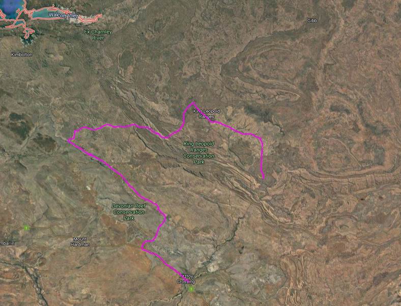
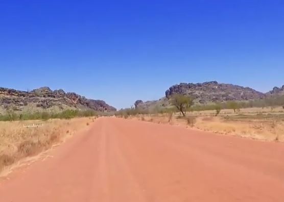
From Fitzroy Crossing, drove 43kms west on the highway, then took the Fairfield-Leopold Downs Road – unsealed – for 124kms, to link us through to the Gibb River Road. This road was quite corrugated and rocky in parts and was fairly slow going.

We did not stop at either of the National Parks along this road – Tunnel Creek and Windjana Gorge. John and I had camped at Windjana Gorge in ’93 and explored both. M had visited them on her previous only trip to these parts – a short tour from Broome, undertaken on a tour package with her mother, a few years back.

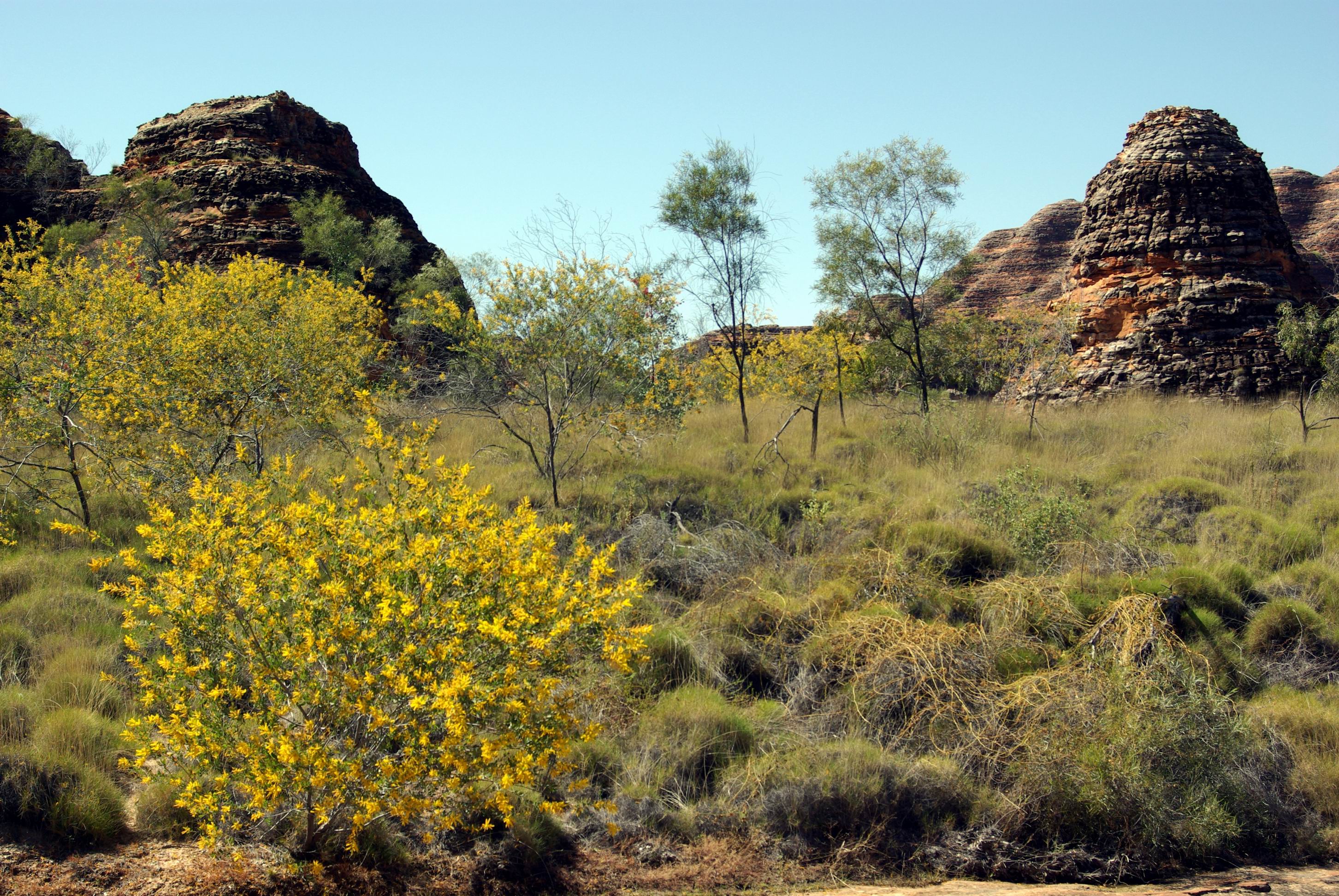
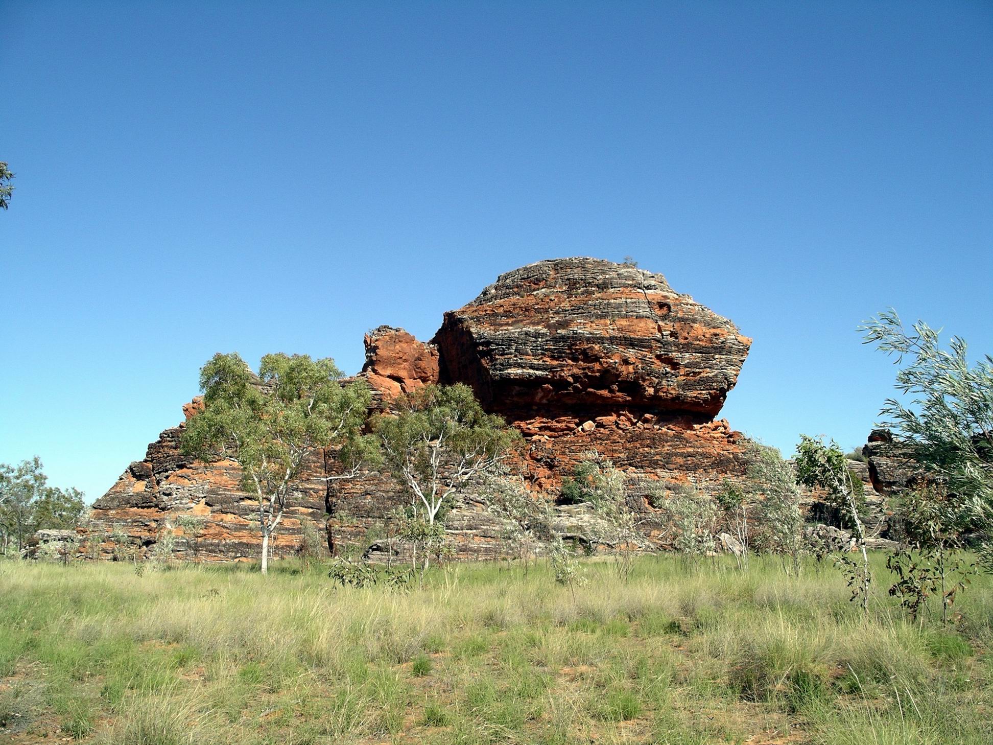
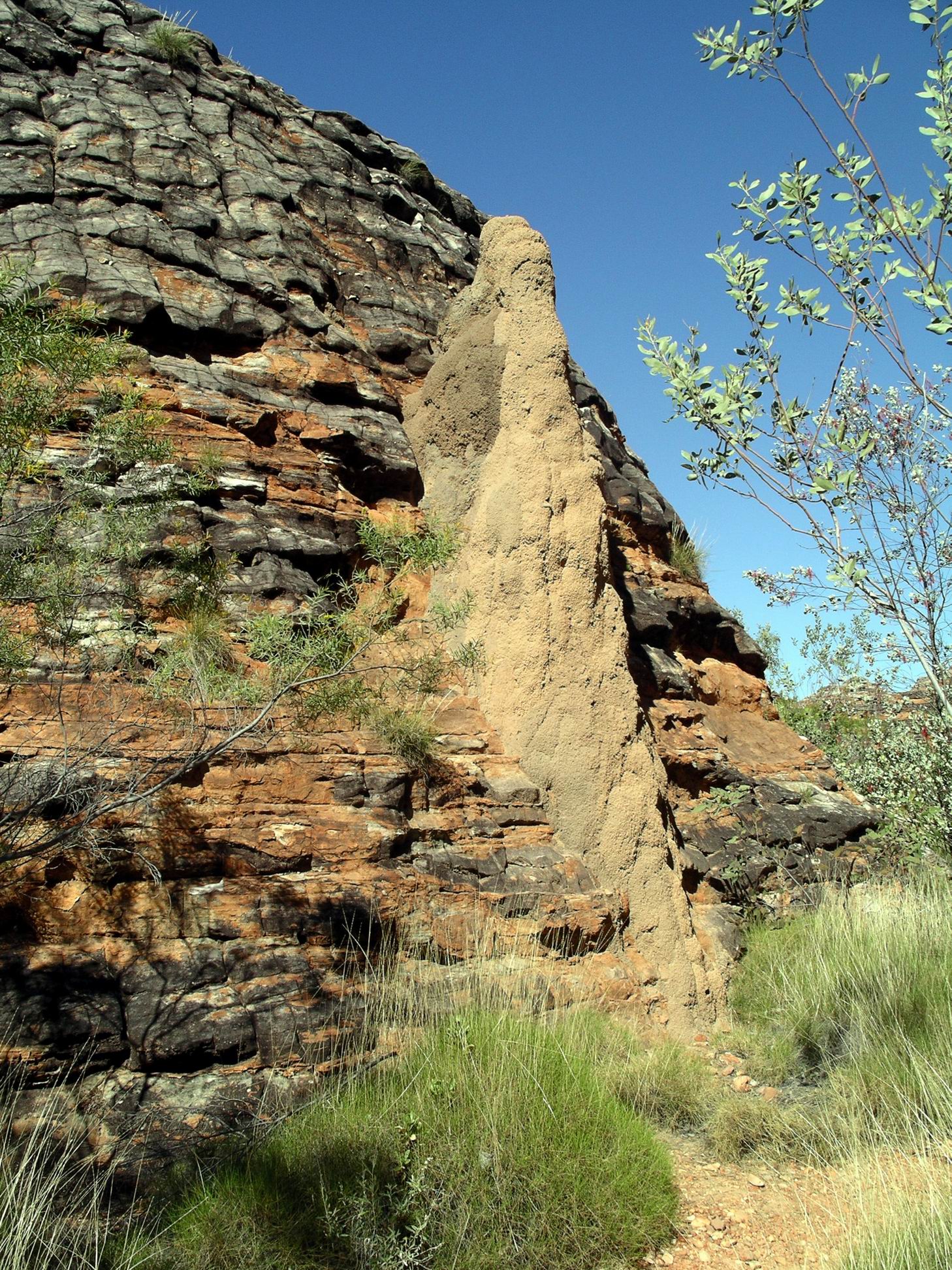
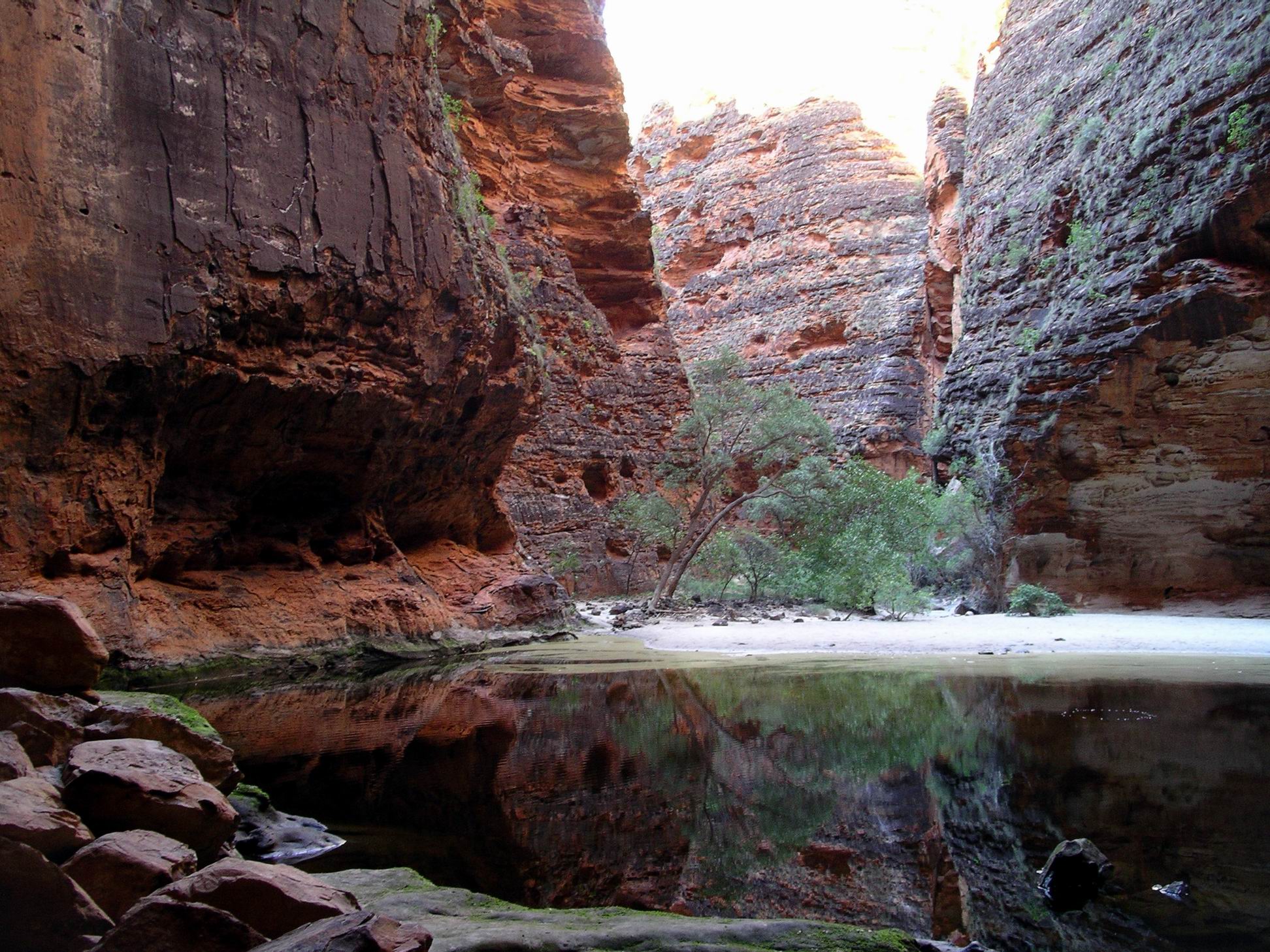
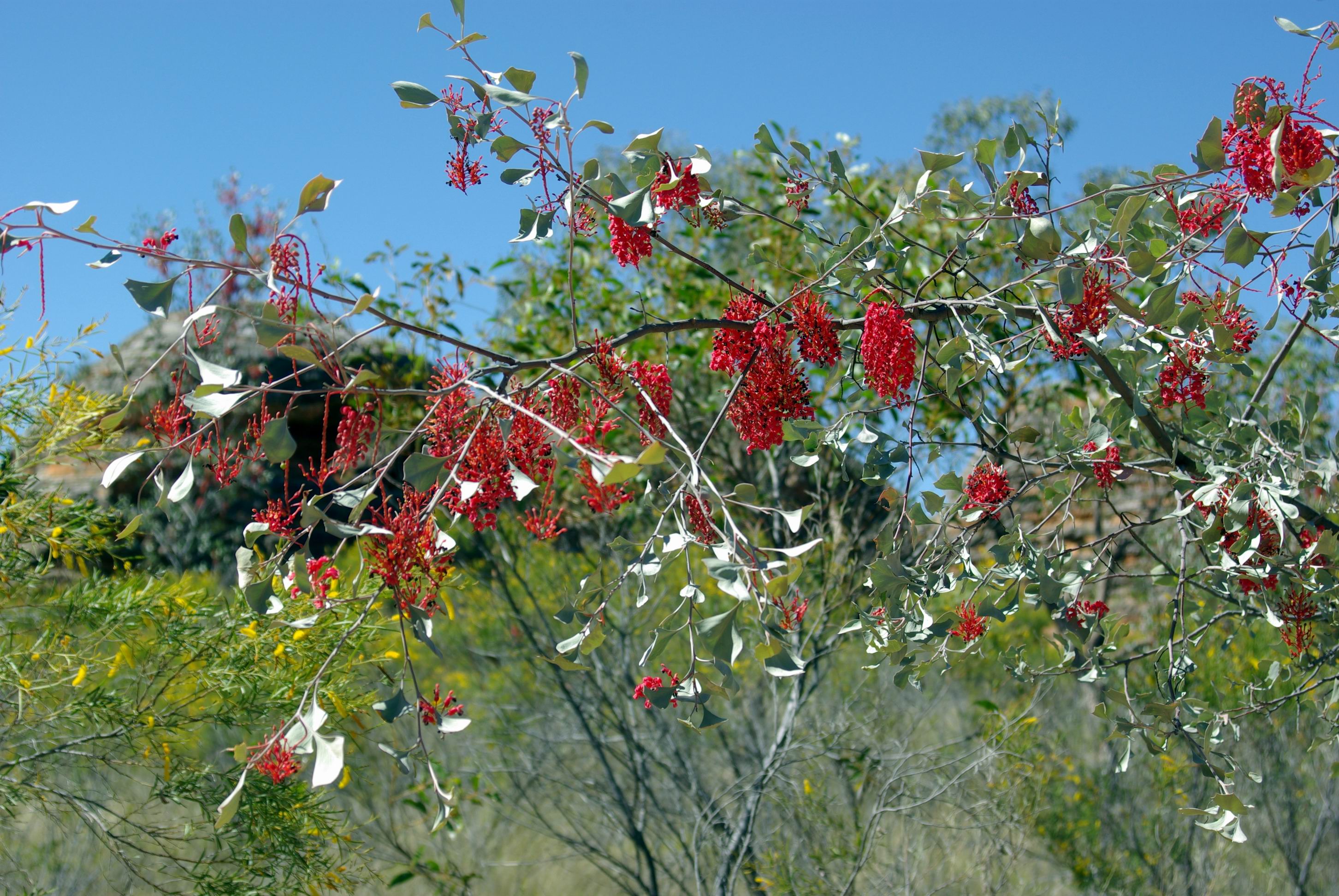
Today’s was a very scenic drive. This western end of the Kimberley is all former Devonian Reef ranges – quite rugged.

Australian Bustard seen along the way

After we turned onto the Gibb River Road and headed east, these ranges were in front of us. It didn’t take long before we passed through the first of several gaps in the ranges – Yammera Gap, with its big rock formation on one side, very aptly named Queen Victoria’s Head.

Approaching Yammera Gap

A couple of the steeper sections through the ranges, like Inglis Gap,  were sealed. There were some good outlooks from some of these, over the wild country ahead.

Through this section, there were several pleasant creeks and we noticed people setting up camps by some of these – even where they were clearly signed “No Camping”.

There was regular traffic along the Gibb. Too much of it was travelling too fast. 4WD’s towing camper trailers seemed to be the worst – even more so than the dreaded overseas drivers of hired 4WD campers. They pass oncoming traffic at great speed, with no thought about the stones and rocks they throw up at others.

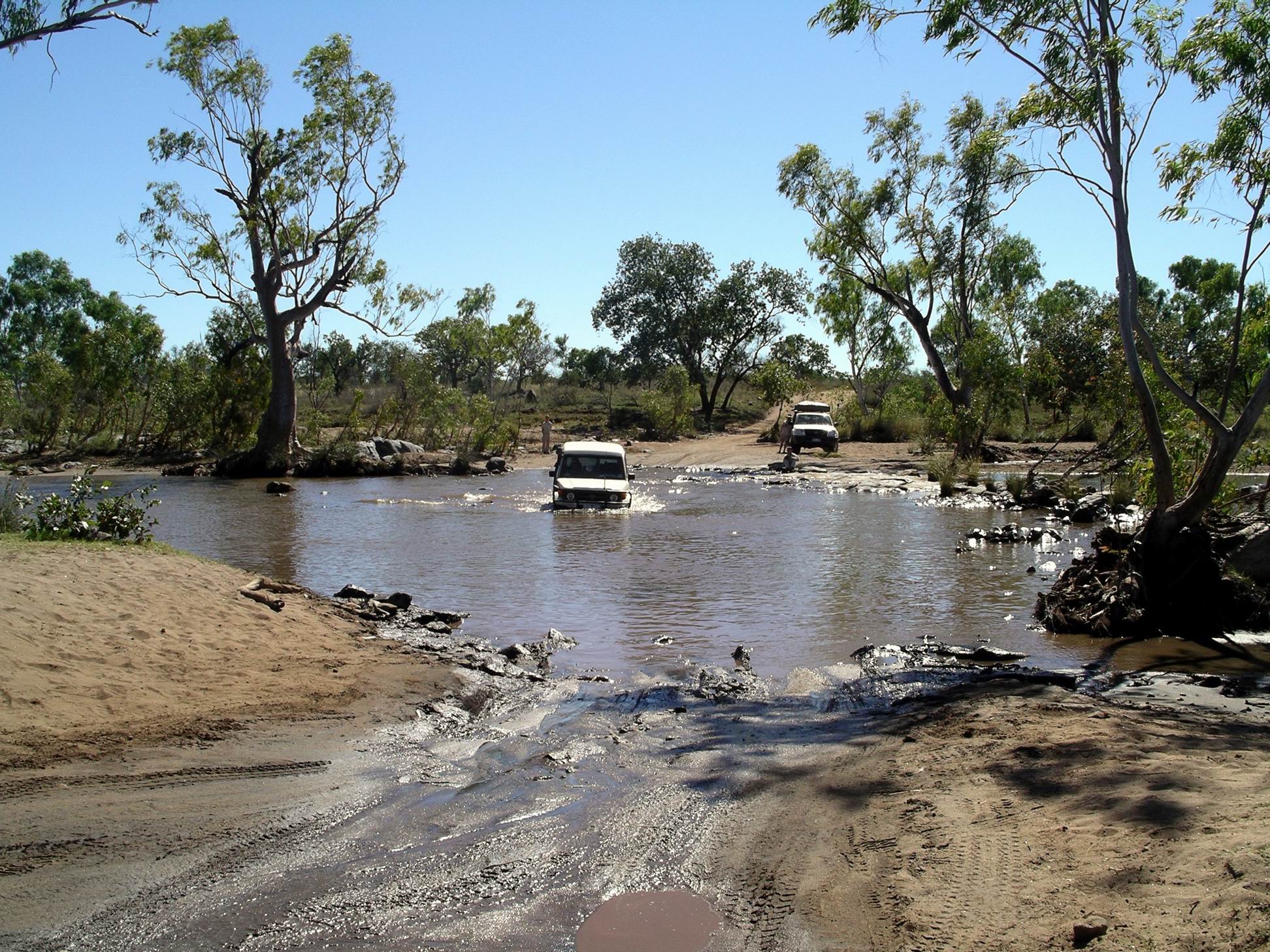
At one point, we had slowed right down to go through a small creek ford in a little gully. A 4WD with trailer came up behind and sailed past us – didn’t slow down at all for the creek. I swear his camper trailer got airborne! These are the travellers who later complain about poor quality roads wrecking their vehicles and tyres – we have seen and heard it all before.

It seems to be an unfortunate fact that, these days, any area/road that is designated “remote” ” an adventure” ” challenging” brings out the most moronic of the idiot drivers – a scary number of them. I don’t give a damn if they spoil their own rigs, and holiday plans, but object mightily when their stupidity affects the sensible minority.

Some 95kms along the Gibb, we parted company with M for a couple of days. She took the side road to Silent Grove and Bell Gorge and planned to catch up with us later, at Mornington. John and I had previously camped at Bell Gorge and it was now one of several places along the Gibb that was very popular, and hence often crowded.

Only a few kms after the Bell Gorge turn off, was the Imintji Store. This had not been here the last time we were at this end of the Gibb, and was linked to the nearby little community of the same name.

We’ already done 300kms since filling last at Fitzroy Crossing, so refuelled here – $1.85cpl. Bought an icy pole for John and a cold drink for me. Chatted a bit with the very nice lady behind the counter – she and her husband had been contracted to run the place for this season, on behalf of the community.

Another 25kms brought us to the turnoff we wanted, to the south east. A hundred metres or so down this road (which also went to Mt House Station), was a roofed shelter, housing a two way radio. All prospective visitors had to use this to call the Wilderness Camp, some 90kms distant, to see if there was a vacancy in the campground . This was very sensible of them – it was a long way to go, only to find one was turned away! There was no other legal camping until back on the Gibb. As they strictly limited the number of campers at any one time, to 25 vehicles/50 campers, there was a very real chance of the campground being full.

We were fine, there was room, and we proceeded southwards, on a route that was new to us.

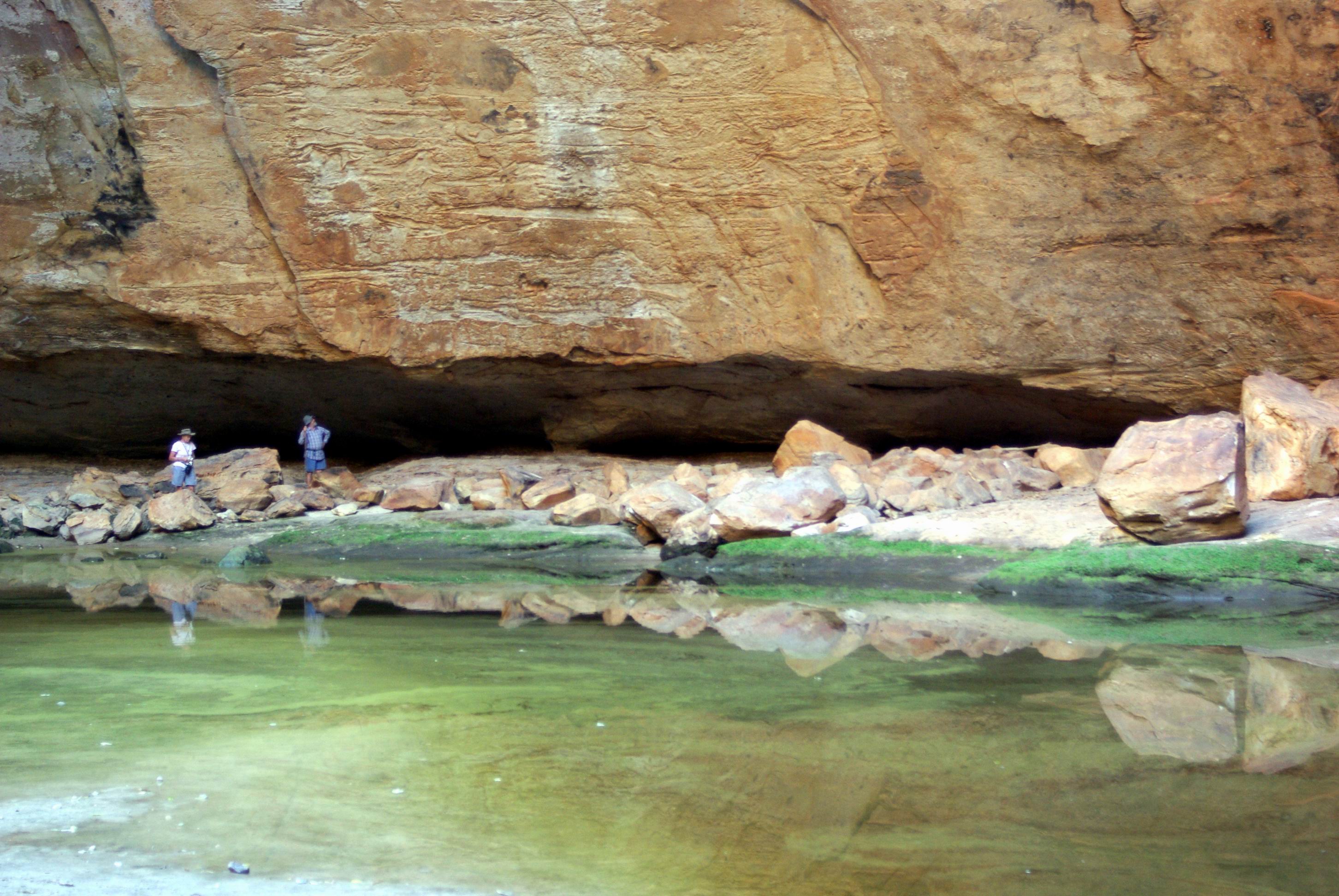
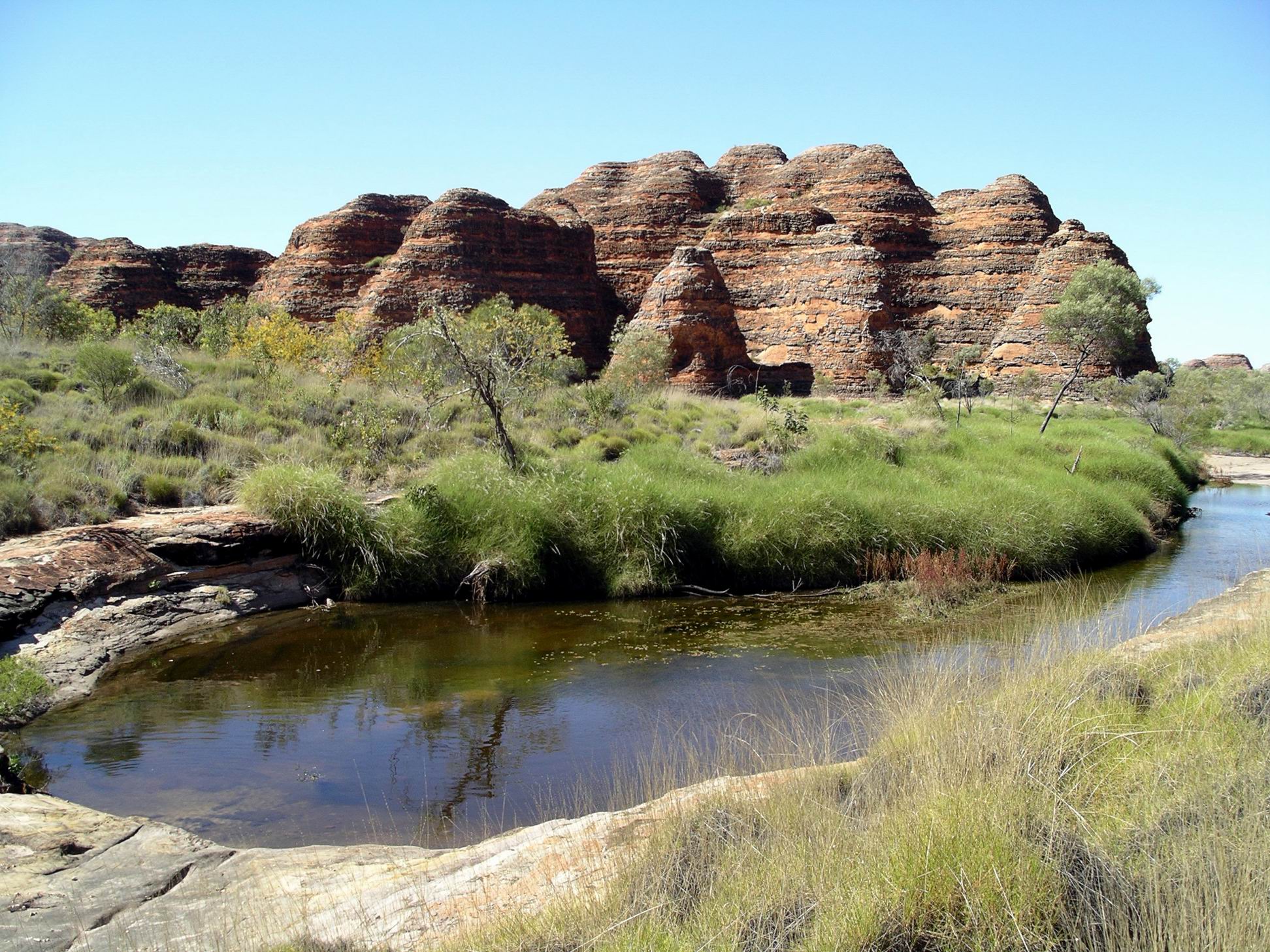
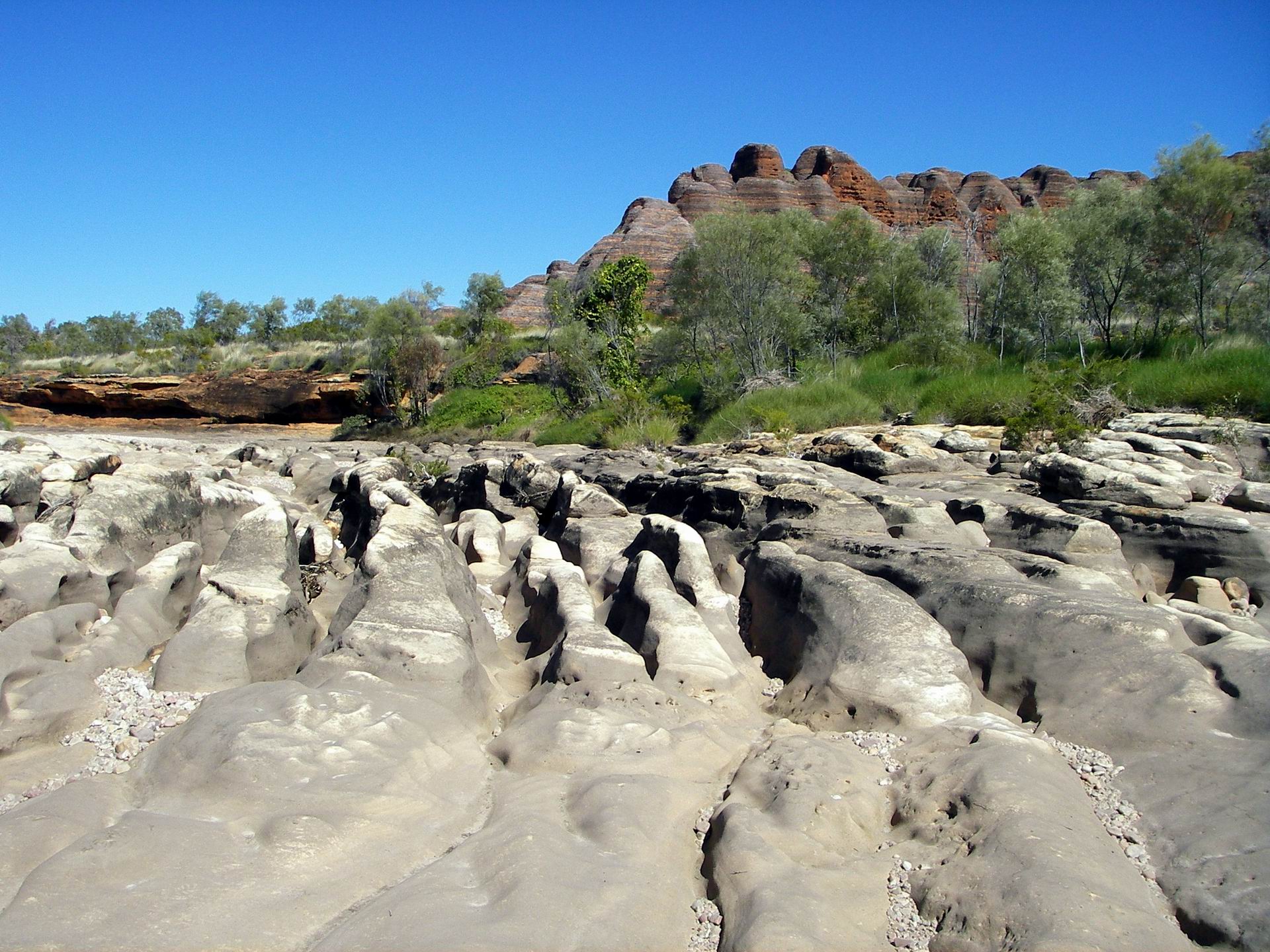
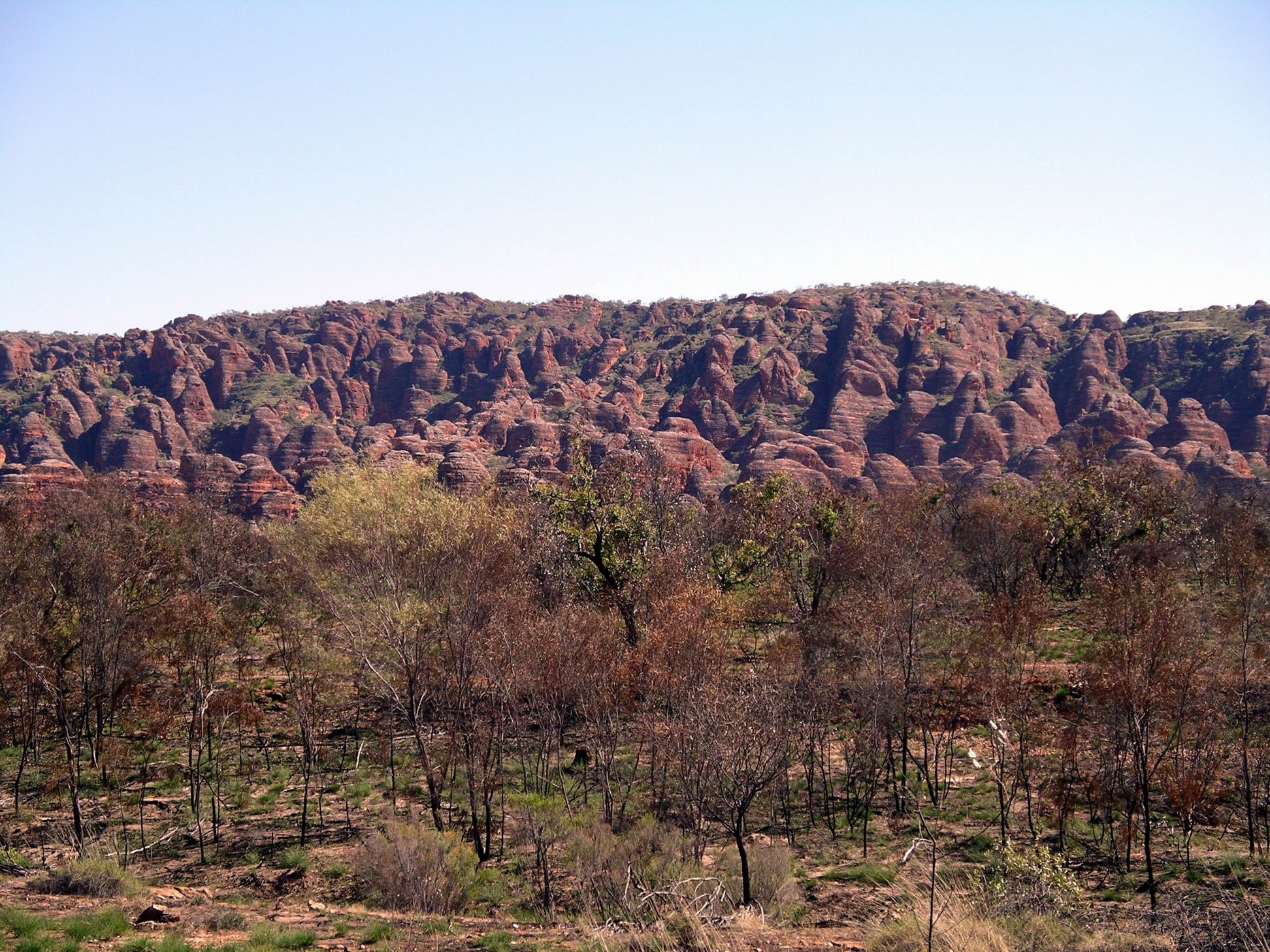
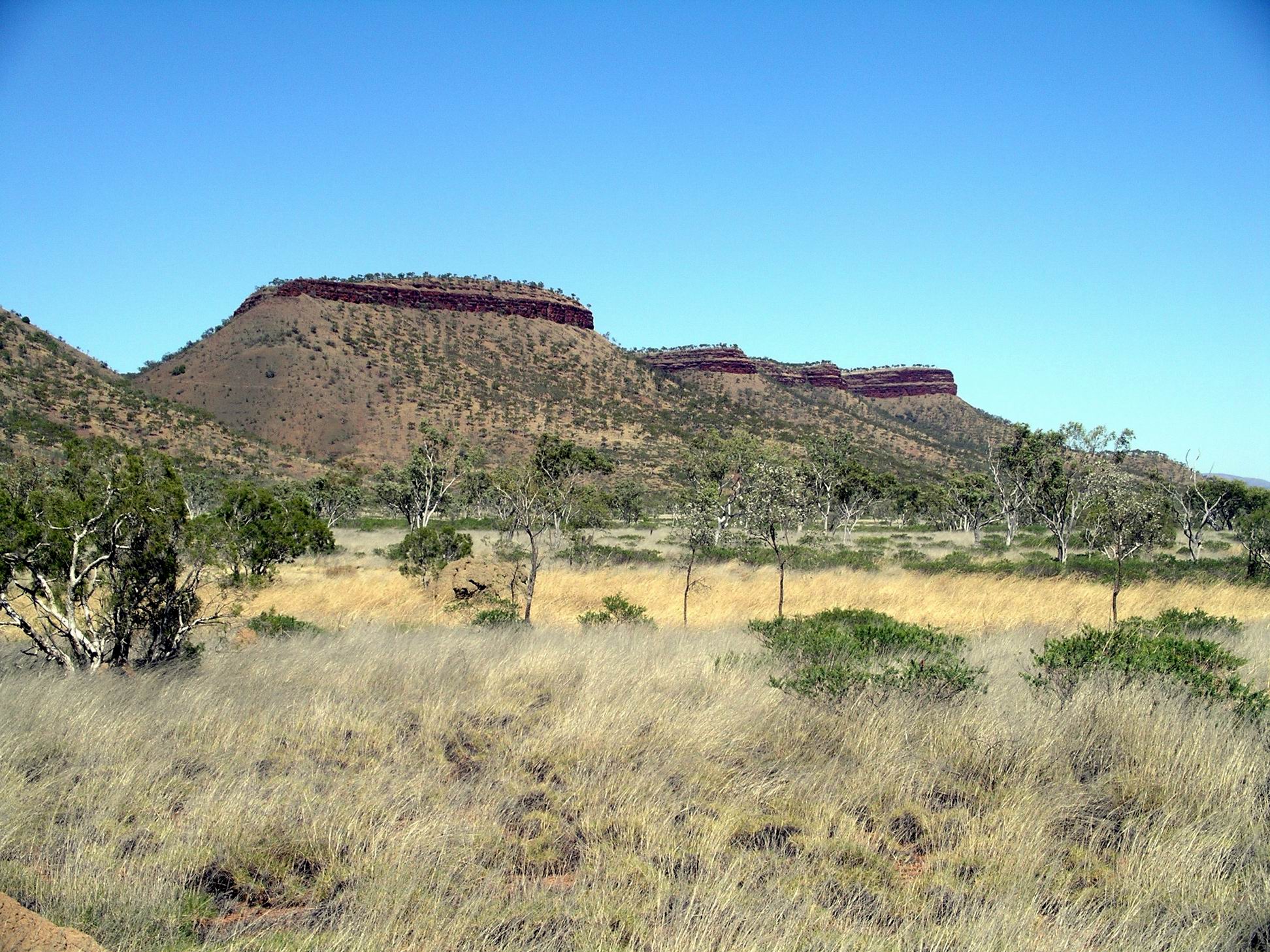
The track was quite reasonable. It took us an hour and a half to do the 90kms. The scenery was really wonderful, particularly when we were running alongside a group of flat topped, mesa like peaks.

There were a number of dry creek channels to be crossed, and occasional ones with a little water in. For the most part, these had been smoothed out by the road grader.

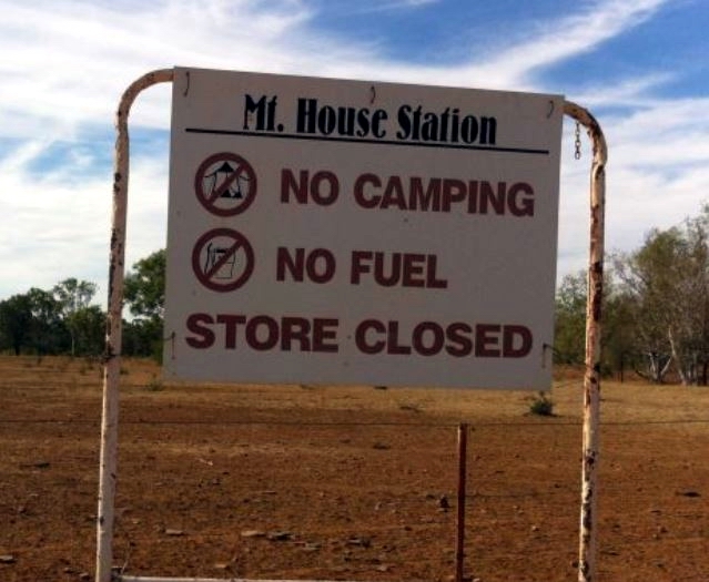
Passed the turnoff to Mt House Station – a cattle operation that did not welcome visitors.

Navigating from a map with a scale of 10km to the cm definitely involved a degree of guess work, given the myriad of station tracks, not marked on the map. I thought I’d identified the turn offs to Moll Gorge and then the Tablelands Track. The latter, in particular, gave me some angst because, if I was wrong, we could have veered right when we should have gone left!

So, I was quite relieved, shortly after, to recognize the site of the old Glenroy Meatworks. We were still on track. This had been the focal point of the Air Beef Scheme, set up after WW2. Cattle from quite a wide radius were brought into the abattoirs/meatworks at Glenroy Station, slaughtered, and the carcasses flown, soon after, to Wyndham, where they were frozen for shipping onwards. So there had been a large airstrip at Glenroy. The making of the Gibb River Road, in the mid-60’s, provided the alternative to cattlemen, of road transport of stock to markets, and so the Air Beef Scheme closed down.

For the final few kms, were winding back and forth across stream tributaries of the Adcock River, an upper tributary of the Fitzroy River. Annie Creek, beside which Mornington Wilderness Camp is located, is one such tributary.

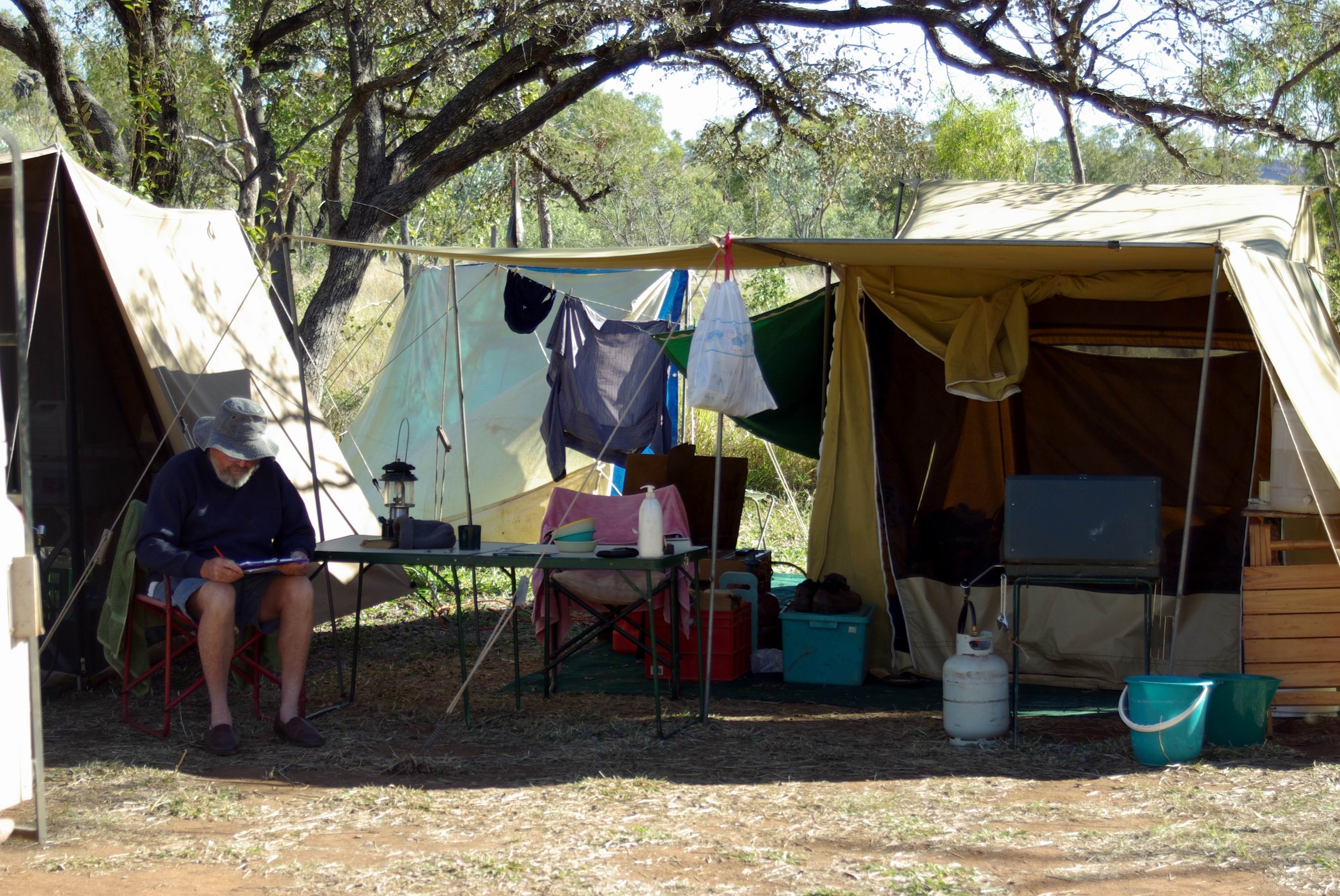
Drove through the campground area and found the main building a bit further on.  There, we booked in for five nights. Sites were $30 a night – no power, of course. Had to pay a $20 entry fee to the property, too.

There were really good, thick, woollen beanies for sale, with the Australian Wildlife Conservancy monogram on. I bought one – $20 – thinking it might help keep my head warm at night, when trying to sleep.

It hadn’t been hard to spend $190 here, in just a few minutes!

We then had to drive back to the camping area, which was strung out along the creek, and pick out our own site from amongst the empty ones. Sites were mostly just clearings in the bush, some of them off an access track that ran parallel to the road in.  Probably about half the sites were occupied – the very best of the secluded, shadiest ones, at the northern end, were taken, but we found a good place to set up in the more southern section.

The Wilderness Camp was within the Mornington Sanctuary – a former pastoral lease owned since 2001 by the Australian Wildlife Conservancy. This private conservation group was doing great work on a variety of environmentally significant properties across Australia, underpinning their conservation efforts with really thorough scientific research.

I didn’t mind paying these sorts of fees when any profits went to support the work of such a group.

When we had been travelling in the Kimberley in 2000, I had planned for us to stay at Mornington, where the then station owner had set up a campground, like others that were springing up across the region, in response to growing traveller numbers. The remoteness of the place – being off the usual traveller route – had appealed to me. From there, we were going to try to drive the Tableland Track, back eastwards, to the Bungles area. But the fates intervened and that part of the planned Gibb River Road trek didn’t happen. When I read, the following year, that AWC had bought Mornington, I was sure the chance to explore that area was gone. But, the organization decided to keep a camp operation going – and here we were.

The campground amenities were very good, with flush toilets and warm showers.

There was also some safari tent accommodation in a different section further along the creek. There is only one commercial tour group allowed to access the property – Outback Spirit, and their tours use the safari tents. I believe that policy reflects a positive view about the environmental credentials of Outback Spirit. When we had worked at Adels Grove, that company had brought tour groups through; I always found them the best groups to deal with.

So, with limited numbers, the place never feels over run by people – unlike some places along the Gibb.

It was getting dark by the time we were fully set up. John found a small piece of board in Truck, that he normally used for packing between things. He was able to place that across the framework on my broken camp chair. With the addition of an old cushion – also used for packing – this would do me for the time being. The actual framework of the seat was quite sound, it was just the canvas seat that had weakened. We inspected John’s chair but the canvas showed no signs of tearing. However, he will be very careful when sitting down, to lower himself very gradually. I also had the option of using a little folding stool that occasionally saw use when John was fishing.

John also found that one of the front tyres was going flat – a slow leak.

We’d parked Truck in a way that would ensure there was still room for M’s rig, in case any other campers decided to set up in our little clearing.

It felt rather strange not to have M around camp.


2 Comments

2007 Travels July 11

WEDNESDAY 11 JULY   KURRAJONG CAMP TO FITZROY CROSSING   460kms

It took us a couple of hours to pack up. That’s the down side of tent camping.

The trip out to the highway was fine. The access road to the Bungles had a reputation for often being really corrugated, but not this time. Perhaps the rains had smoothed it right out? More likely, there had not yet been enough traffic on it, since it was graded at the start of the tourist season.

The Fletcher Creek crossing – which I had been quietly dreading – still had plenty of water in it, although the level had dropped considerably since a week ago. It was still enough to be a deterrent to some travellers.

The crossing was still too damned rough! A man on the highway side as we crossed, took some photos of us. We talked with him after we got through safely, and he said he would email me copies of the photos of Truck doing the crossing. (He never did).

I took photos of M driving across.

Then it wasn’t far to the highway and the 120kms or so to Halls Creek and diesel. In planning what we did in the Bungles, we had been aware of the need to conserve fuel, within reason. The thinking went like – it was about 160 kms between Turkey Creek, where we’d topped up the tank, and Halls Creek, where we would refuel. The access road, in and out, added about 120kms to that. Although we’d never tested it out, the range of a tank of fuel should have been around 550-600kms. So we had two or three hundred kms of driving in the Park to play with. It hadn’t been hard to accumulate those – a return trip from camp to Piccaninny Creek was 64kms – and we’d done three of those, for starters. Still, as it worked out, John thought we had enough diesel left to get comfortably to Halls Creek, without having to top up the tank with the jerry can.

The best laid plans……..

There was no diesel to be had in Halls Creek! They’d had a lot of multi-vehicle tag-a-long tours come through and the fuel tanker was running late, by a day or two. They “thought” he might be in tomorrow…….or the next day. Now, Halls Creek was not a place we wanted to stay, although it was not as bad there as it used to be. There were a number of very disgruntled travellers already staying there, waiting for fuel.

Also, did not much like the idea of filling up from a freshly filled servo supply that had been depleted – that was the way to finish up with gunk in the fuel.

So, we decided to try to make the 290kms to Fitzroy Crossing. John emptied our 24 litre jerry can into the tank. Whilst he was doing that, I bought a few necessary groceries.

Our plan of attack was that, if we did run out of fuel, M would take the empty jerry can and fetch us some from Fitzroy Crossing. She had no worries – with her dual tanks, she had plenty of fuel herself – but we had no way to access any of hers. It was a bit of a gamble, but John thought we could make it. If not, and we ended up with issues like having to bleed fuel lines, so be it.

I tried to phone the caravan park at Fitzroy Crossing to book sites, to make sure we would not get caught out there – but they didn’t do bookings! This day was rapidly going downhill….

We drove at a more economical speed than usual – about 85kmh. That made for a very long seeming 290kms.

We did seem to be a bit jinxed on this section of highway – in 2000, we “did” a wheel bearing on Truck, along there.

After a rather tense drive, we reached Fitzroy Crossing about 4pm. Immediately refuelled, at the Lodge. The gauge read empty, the odometer read 882kms, and the tank took 72 litres. It was supposed to hold 75 litres, so we’d  been just about running on fumes, I reckon.

The diesel cost $1.44cpl.

Of course, there were no powered sites left at the Fitzroy Crossing Lodge Caravan Park. They charged us $22 for an unpowered site. I really disliked the attitude of the Reception staff – they made it very clear that campers were low on their customer priority order. A pity, because otherwise it is a very nice park – well grassed on the powered sites, with modern amenities, and well set out.

However, the unpowered section that was our lot, was rather unshaded, dry and dusty.

We had planned to treat ourselves to a meal “out” at the Lodge’s motel restaurant, but after the unwelcoming attitude encountered, decided to keep our money and spend it somewhere else, later. M and John did walk up there and bought a bottle of wine, each, though – a treat.

I had just a cup-of-soup for dinner, John had an instant noodle dinner, left over from his hike food. Low cuisine to go with the wine!

It was a bit annoying having to put the tent up for just one night, but the motel units here were too expensive for us to contemplate a night in one of those.

The showers were wonderful! Hair wash was much needed…..

Phoned son. No change on that front – he still miserable.

It was another very cold night. So much for my hopes that being a bit closer to the coast would have a warming effect.


Leave a comment

2007 Travels July 10

TUESDAY 10 JULY     KURRAJONG CAMP

It was another very cold night – felt like close to zero.

M was away early to drive to Walardi camp area, maybe 20kms away, and the nearby helicopter area. She had booked to do a 9.30am flight over the Bungles. It cost her $260 for half an hour. She was hoping to see from the air some of the areas she and John had explored over the past couple of days.

John did not want to do a flight, as he had done one when we were here in ’93. I prefer my feet on solid ground!

We rendezvoused with her at the Piccaninny car park at 11am.

M had enjoyed the flight and had seen the creek area we walked. The “rules” prevent the helicopters from going close in to the gorges, or too low.

In particular, she was impressed by the expanse of the Bungles, beyond the relatively small areas that the public can access.

Some of the gorges they flew over were little more than clefts in the rock.

We walked to Cathedral Gorge. That was the seventh and eighth time I’d walked that bit of track, in a few days! Wet feet again……..

The recent rains had ensured a profusion of flowering plants…..

There were more people in the Cathedral chamber than when I was here yesterday. However, the tour group ones did not stay long and then there were just a few of us left there to really take our time soaking up the atmosphere of the place.

It really was quite towering and majestic, and hushed. The name was quite appropriate.

Looking up, from inside The Cathedral

Returned to the grey bedded Piccaninny Creek. Walked up it – again – for a little way before branching off on the Lookout Track. Followed this to the Lookout, which gave some distant views of clusters of domes, as well as glimpses of the plains beyond.

From the 21st century perspective, it seems amazing that this really unusual and special area was not really appreciated by Europeans for its potential, until the 1980’s. To the local graziers, it was just part of the countryside, until it was featured in a TV program in 1982. In 1987 – just six years before our first visit here – it was declared a National Park.

On the way back to the vehicles, we detoured to walk the Domes circuit (again).

Found a side track that I’d missed, yesterday. It led to an area where there was some aboriginal art – hands and the like, and a little pool that was like a mini Cathedral.

Back at camp again, discovered that our bag of rubbish – carefully  hung up to be out of the reach of predators – had been raided by some of our feathered friends. I should have taken it with us in Truck.

It could only have been birds!

For the rest of the day, downloaded photos onto my laptop. Lazed about.

We stirred ourselves to do a little bit of preliminary packing.

The week here had gone so quickly, but between us, had explored much of what there was for the general public to do here. I wondered whether, in the future, more sections and walk tracks would be opened up. Or whether there was enough to manage, as it was. Anyway, given the relatively short period that most visitors stayed for, there was enough to occupy them for a couple of days.

This would actually be a great place for grey nomads like us to volunteer to work, for a season, doing something like staffing the Visitor Centre. Imagine the places one could get to see on days off!

It had been a very pleasant camp spot – and not exactly crowded……..


1 Comment

2007 Travels July 9

MONDAY 9 JULY     KURRAJONG CAMP

I had another good night’s sleep, although it seemed colder. Being less exhausted, maybe I just noticed the cold in the night. I was up at 6.30am. Pottered about, getting stuff organized.

Breakfasted, then drove back to the Piccaninny car park, stopping along the road a couple of times to take photos – a luxury I am not often afforded when someone else is driving!

Holly Grevillea along the way

I set out again on the same track, but soon deviated to tackle the short Domes side walk.

I knew that the other two would take some time to walk back from their camp, so thought I had time to sidetrack – just in case it was later decided we wouldn’t come back this way.

Also – I didn’t want to walk too far to meet them, only having to back track along the same route I’d trudged a couple of days ago!

The Domes circuit provided a really good encapsulation of typical Bungles domes – a way for most visitors to see in a small area what we had expended a lot of effort to visit further along!

From there, it wasn’t far to the next side track – to Cathedral Gorge.

Because of the recent rains, there were lots of pools on and beside the track, as I walked in there. Had to wade at a few points and got wet feet. There were a couple of short ladders to climb too, that took the track around difficult bits.

The track to Cathedral Gorge
Getting closer on the narrow track

I was really lucky to get into Cathedral Gorge in between tour groups. There was only one other couple in there while I was taking photos.

Way in to Gorge

The Cathedral is a huge amphitheatre type of cavern formation at the head of a gorge.  In its base is a large pool.

Pool in Cathedral Gorge, and the black rock of a waterfall course

The curved rock roof causes sound to be amplified and echo. The roof is partly open to the sky. In one section, a black stained rock wall that denoted a wet season waterfall, reached up really high. There must be an awesome torrent pouring down there when it really rains.

The Cathedral
Reflection in the Cathredral Pool
The Cathedral Pool and the way out again

On the side track back from Cathedral Gorge, I passed heaps of tour group travellers walking into the Gorge. How lucky had I been?

At the corner with the Creek track, had a little debate with myself. Was it just possible that the intrepid two had made really excellent time and gone past this point towards the car park? Logic said not – but I thought I’d best play safe and check.

So I tromped the km back to the car park. No hikers. Tromped the same km back again, then continued on up the Piccaninny Creek bed.

I only got about a km along from the Cathedral Gorge turn off, when I turned a bend and there they were, heading my way. It was right on midday. They had made good time – five hours since they’d left their camp, some 12-14kms away.

John heading back along Piccaninny Gorge
Debris showing the extent of floods along here

They’d had a great time, and were “high” on the achievement.

They hadn’t explored the full lengths of all the little finger gorges at the top of the main one – too much boulder hopping, verging on rock climbing. But I thought it was a great effort to do what they had done, especially 66 year old John with his one replaced hip and another well on the way to needing same.

One of the hardest walking sections

Loaded them and gear into Truck. On the way back, detoured into the airfield area near Walardi camp, so M could check out the sightseeing helicopter flights. On our Piccaninny Creek walks, had heard and seen these overhead.

Then drove back to the Visitor Centre to de-register them. More cold drinks were purchased!

Back at camp, they unpacked. In the wash-up dish, I hand washed John’s dirty gear, and my socks, which were wet and dirty from having to wade on the way into Cathedral Gorge.

Then we all relaxed over late lunch and into the afternoon. They had lots of anecdotes to tell me – and remember, themselves.

The wildflowers in the Park were truly spectacular, we had noted. I’d seen a superb red variety of holly grevillea, and a  golden rod type wattle was also notable.

Holly Grevillea

 It was good to have company again, in camp, even if it did mean I had to share the bed clothes!