
The area:
We were supposed to have one day off a week. This was sometimes irregular, due to demands of visitor numbers, but was made up later.
On some of our days off, it was hard to get motivated to do much except sleep in, laze around at the van, maybe have a swim in the shallow part of the creek. It was a measure of our inertia that, from the time we left Gregory Downs, till we left Adels, we did only about 600kms – and most of that was done getting there, and in our brief tourist time. We bought only 56 litres of fuel in our time there – at $1.22 cpl.
But we did get out and about a bit.
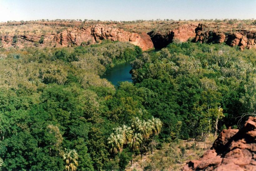
There was a short walking track, from Adels, up a nearby low hill – Lookout Hill, from which there was some outlook over Adels and the nearby country.

From Lookout Hill, looking to the Constance Range & the gap the National Park road goes through
A bit further afield – and a short drive – was the track up Bill Hill, which was somewhat higher and gave better views. From that, one could just see the overburden hills of the Century Mine, to the east.

From Bill Hill, moonrise over the zinc mine
One of the staff couples were in the habit of going off for an overnight of camping, on their day off, just to get out of the place, and away from people. They did not go far – just to nearby Louie Creek, or out to the NE, on Lawn Hill Station, further down Lawn Hill Creek. They had the permission of the station managers to do this.
A few times, we went for short walks in the National Park. One of these took us to the little Cascades, that had formed over tufa rocks – like a very miniature Indarri Falls, and similar to our little falls in the creek, up from the laundry area. Beyond these Cascades was the entrance to the Lower Gorge – out of bounds for canoeists and walkers, except where a walk track touched on it, at the back of the Island Stack.
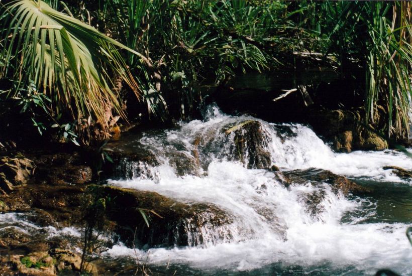
Little tufa Cascades at the National Park
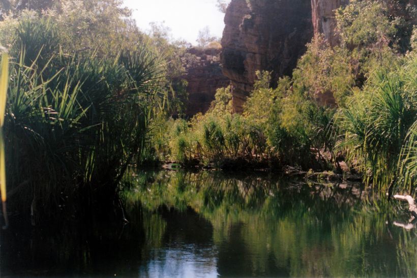
The entrance to the Lower Gorge

The Island Stack and walk track to the Lower Gorge
We did go for an exploratory drive, one day, to the north, through Lawn Hill Station and out along the track to Doomadgee, for a way. It was quite easy to get lost in the maze of station tracks around the Lawn Hill homestead. This in itself was an interesting place, perched up high on a bluff above the creek. It was quite an imposing looking house. Below the bluff were lots of sheds, cattle yards and the airstrip. The track to be taken north wove amongst these – very poorly signed – and eventually skirted the bluff and the airstrip, before crossing Lawn Hill Creek further along, and then becoming easier to follow.
Lawn Hill Station quite intrigued me, so I found out what I could about its history from the Boss. The station had been a pastoral lease since the 1870’s, and was one of the largest stations in Qld.
In 1976, a Brazilian cattleman, Sebastian Maia, bought the lease and proceeded to oversee a very successful station. In 1991, the lease was sold to CRA/Rio Tinto, who acquired it and Riversleigh station, in order to do a deal with the local aboriginals, that would allow the zinc mine to go ahead. Although Riversleigh had been ceded to aboriginal control by the time we were in the area, lawn Hill was a little different, in that Maia’s company had a lease back arrangement for a while and continued to run cattle on the property. By 2002, managers were running the place for the company.
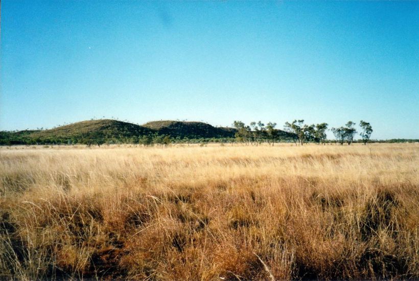
The Constance Range on Lawn Hill Station
In 1984, Maia had donated an area of land to the Qld government, to be managed for the public good, for all Australians. That became Lawn Hill National Park. He added more land to it in 1992. It would appear that he never had any intention that any of his lands would come under aboriginal management or ownership; at the stage when he came to Lawn Hill, there was no record of significant aboriginal occupation of the area in recent times. It was unfortunate that his generous gifting of the spectacular gorge area for future public access and good – and the decision by the Goss Qld Government to re-gazette the land away from its original pastoral lease status – opened the way for aboriginal claim to the Park.
I read a very interesting – and eye-opening account – of the way the local aboriginals behaved in the Park, and treated the wild life, when they attended for a meeting about the proposed mine – in “Three Years on the Road” by Brett Davis, who was working there at the time. It was also interesting for its description of Adels in the late 1990’s.
On top of a prominent hill, some distance north of the homestead, Maia had a large white cross erected, in memory of his mother. This is a real landmark on the track to Doomadgee.
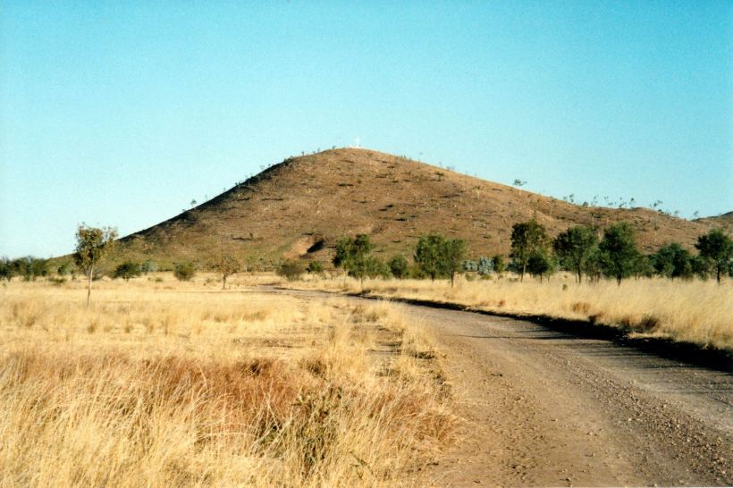
The Cross on the Hill by the track to Doomadgee
We did some more walking in the National Park.
The Island Stack Walk went to the top of a bluff that overlooks the Lower Gorge. The name derives from the fact that one side of the bluff is the creek and gorge, the rest of it is circled by an old channel of the creek, now a small stream. Thus, an “island” had been formed.

The Island Stack
The track up was a steep, short scramble. The views from the top were excellent. One could see right down the gorge and creek.
The Middle Gorge entrance, seen from the Island Stack

Lawn Hill Creek beyond the Lower Gorge, from the Island Stack

The Lower Gorge, from Island Stack
We also followed a track beside the old channel/small creek, that took us round to the Lower Gorge, at creek level. There was only access to this at this one small point, to protect wildlife, and sacred sites.

The Island Stack and the Lower Gorge
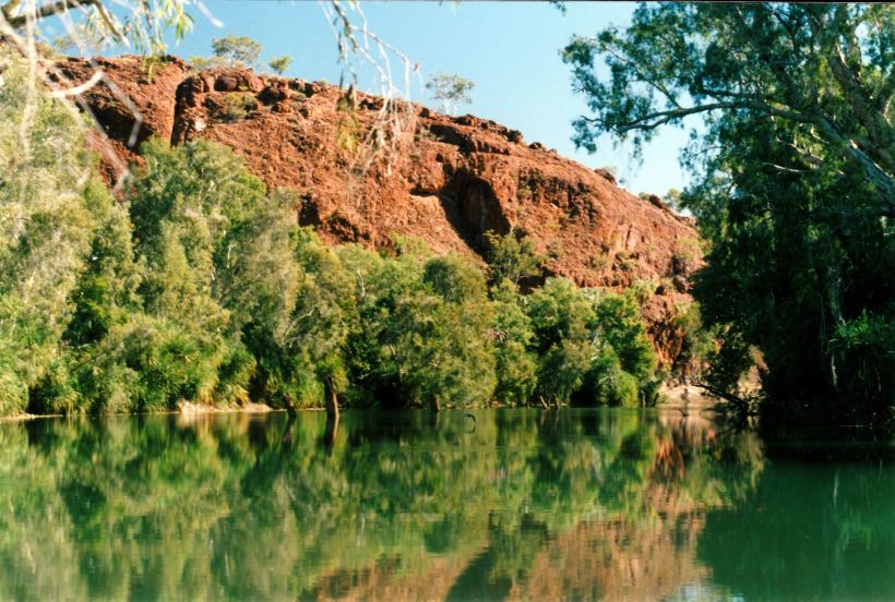
The Lower Gorge wall
