
MONDAY 25 JANUARY STANTHORPE
We woke to a grey, slightly chilly morning. Despite that, decided to stick to the plan we made yesterday – to go to Boonoo Boonoo National Park (pronounced bunna boo-noo).
To get there, took the Amosfield Road out of Stanthorpe, which took us across the border into NSW. It is nine months since we have been in NSW! Then followed the Mount Lindesay Road south – a fairly narrow back road. Took the signed road to the Falls – 14kms of unsealed road, not too bad.
Then we walked to the Falls – not far. They are very long, over a series of drops and then the water goes down into a gorge that is the upper Clarence River system. There was quite a bit of water coming over.
We then walked to a pool above the Falls – Top Pool. People swim there, but today’s weather made it not a tempting idea. It is pretty, amongst big granite boulders.
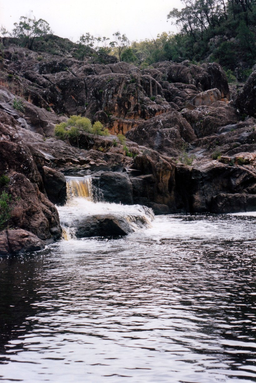
The Top Pool at the Falls
Whilst walking alongside the creek, I disturbed an eel that was rock-hopping. I thought it was a snake, at first – got a big fright.
We ate our picnic lunch there, where there are a few fairly ordinary camp spots. Apparently, management plans may ban camping here, in favour of the Cypress camp area, which we passed on the way in.
Did some bird spotting here – found a dusky wood swallow, spotted pardalote, a crested baza hawk, and a plum headed finch.
On the way back out – retracing the same route – we took a short side track and visited Morgans Gully. It was worth the detour, with big rocks and pools in the creek. Unfortunately, the grey day meant no photos.
It was back on the Mount Lindesay Road for a short while, before taking the access road to Bald Rock National Park, also in NSW, but as the crow flies, not far from Girraween.
Bald Rock is the largest granite rock in Australia. Its top is about 1300 metres above sea level.
Unfortunately, it was 4.15 when we commenced the walk up Bald Rock – too late, really. We took the easier, 2.5km gradual track up to the top, a lovely walk that winds around, as opposed to going straight up the face of the rock. It may have been the easier track, but it was still hard work, going uphill.
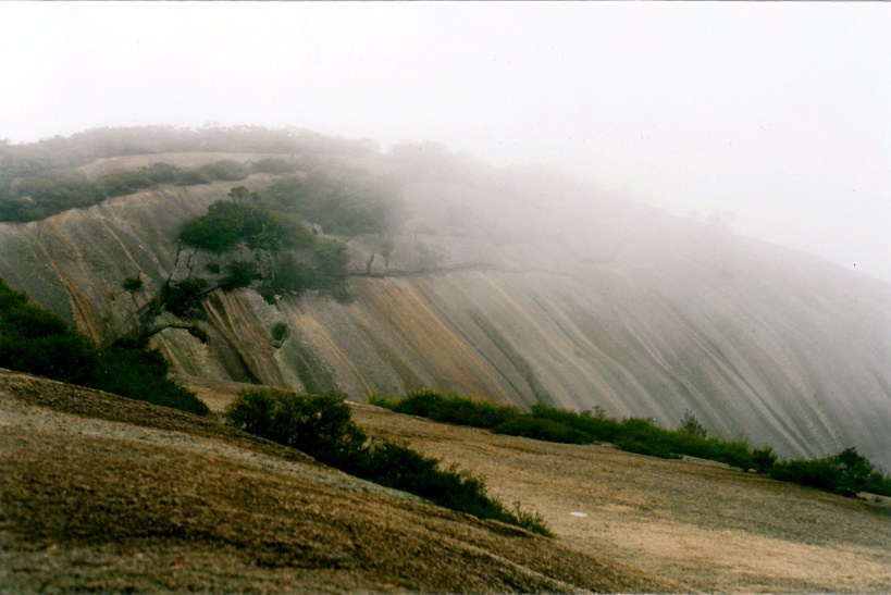
Towards the top of Bald Rock, with drifting cloud obscuring the outlook
Spotted a Pacific Baza hawk – our fourth new bird for the day.
There was cloud drifting over the Rock, so the light was poor for photos – and for seeing any distance! We did come through some interesting canyon and balanced rock formations on the way to the summit.
At the top, signed the Visitors Book. There were no views, due to the cloud.
John decided – partly in view of how late it was – that we would take the steep track back, straight down the exposed rock face. I was rather reluctant, after the issues on The Pyramid the other day. It was getting on for 6pm and I was worried about maybe getting caught in the dark, if he couldn’t manage it and we had to backtrack.
In the event, it was much easier than on The Pyramid. Although steep, and testing on the knees and ankles, there were no exposed side drops, so we did it easily. It was much quicker. The loop walk as we did it, was 3.2kms.
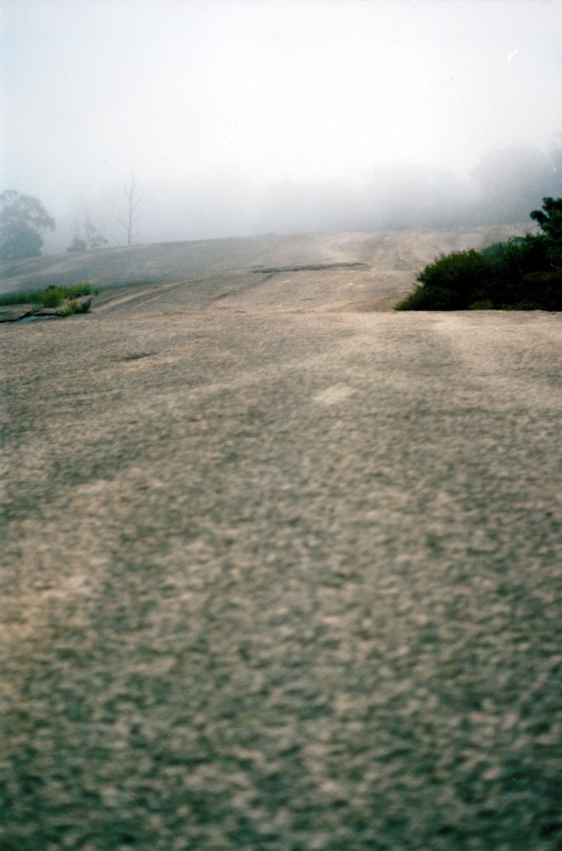
Looking back up towards the top of Bald Rock, after we’d come down the steep face
There was no one else in the car park by the time we got there – too late, too cloudy.
It was still daylight by the time we’d driven back to Stanthorpe – just. John stopped to hire a video, on the way through town. Drove 146kms today.
Tea was soup and toasted ham and cheese sandwiches.
We watched The Horse Whisperer. An excellent film, though there were a couple of holes in the story, if one knows horses. The dance scene was memorable.
I would really like to go back and walk Bald Rock in clear weather.
