This Adventurous Age

Adventures travelling and working around Australia.


Leave a comment

1998 Travels October 15

THURSDAY 15 OCTOBER     MOUNT SURPRISE

We had a “home” day today. Slept in a bit. It was a very hot day.

I did washing and cleaned the van – both very much overdue! There is not a proper laundry here, yet. Just a tub and machine at one end of the recreation room which is another demountable building. But adequate, and there are good clothes lines. My washing soon dried.

John answered business letters and the like.

The groceries arrived on the truck from Coles in Atherton. We have fresh fruit and vegies again! They cost $90 – $12 of which was packing and freight. I was pleased to have been able to get my order along with Jo’s, rather than just having to hope the store had what I wanted – and pay their mark up too.

We went swimming a couple of times through the day.

The Savannahlander train came through – it only had one carriage this week.

When he came home from school, the young son of Jo and Joe took us for a walk to the creek that is not far from the caravan area. He told us about different plants and showed us the creek. It did not have much water in it now, but would be really pretty at a different time of year. I think he could well become a guide, like his dad was – he did a great job.

10-18-1998 bustard Mt Surprise.jpg

A bustard in the bush by the creek

Tea was sausages, onions and egg.

John played his computer game till 4.30am!


Leave a comment

1998 Travels October 14

WEDNESDAY 14 OCTOBER     MOUNT SURPRISE

We got up fairly early again, to go back out to O’Briens Creek.

On the way, stopped in the village for fuel – 76cpl – and a big block of chocolate, to take out to Sam in appreciation of his help.

We went straight to Sam’s to give him the gift, before it got too melty – the day was heating up.

Then called briefly at Diggers Rest. Sam had suggested we drive up to Blue Hills, to the north, and try fossicking up there. We double checked the route, on our mud map, with Gordon, then set off.

The track was the roughest one we’d encountered in our time out here, with a couple of very rough jump ups. I walked the worst – on the pretext of taking photos of Truck meeting the challenge!  Which it and John did beautifully. There was an extensive view to the south from the top of the second jump up – can see how the place got its name as we were quite high up.

10-14-1998 01 blue hills track.jpg

The first jump-up on the track to Blue Hills

As we’d been told, there was a little sign by the road that indicated we’d reached the Blue Hills area. It was about 5 or 6 kms from Diggers Rest. As it was just sitting propped up by a rock at the road side, John picked it up for a photo shot.

10-14-1998 03 Blue Hills topaz fossick area.jpg

Blue Hills found! Area partially burnt

It was different to the country where we’d fossicked, down below. That was mostly centred around the creek. Up top it was much harder to tell where to look for topaz. There were areas of quartz pebbles and small stones in places scattered across the flat ground, and  little creek channels. But there was nowhere obvious that was diggings. The big bushfire had burnt across here, so at least there was fairly open ground.

John specked around in the areas of the little creek gullies.  As I really didn’t know where to look,  and got a bit bored after a while, I wandered off to look at the scenery and take photos. But still kept my eyes on the ground. In an area of quartz wash on the surface, by a burnt bush trunk, I found three big, clear pieces of what I thought were quartz and pocketed them. Showed John when I wandered back near him – he admired their size and we thought they were worth hanging on to.

10-14-1998 04 fossicking area Blue Hills.jpg

The are where we fossicked at Blue Hills

It became very hot in the exposed, rocky area and so we called it quits, after having lunch. Going back down the jump ups was a little fearsome!

10-14-1998 05 view back from top of jump up.jpg

Looking down from the top of the second jump-up – towards the south

Went back to Diggers Rest to return our sieve to Gordon, as we think we’ve done enough fossicking. I showed him the pieces of quartz I found. Was astounded when he said they were blue topaz! The best! Three great big chunks of same. What a fluke. I told him how I’d just found them sitting on the top of the ground. We concluded that they must have been under a thick bush, that got burnt in the recent fire, thus exposing them. You can be in the right place at the right time……What a good way to end this little adventure.

10-09-1998-obriens-creek

O’Briens Creek fossicking area. Blue Hills area is right up at the top of map

Back at camp, there were neighbours in the next site, with quite a big van. It seemed a bit saggy at each end. They are also planning long term travel – in their case, ten years or more. Right now, I’m aiming for five or six years for us. They went out in the late afternoon to fossick.

I made curried tuna and rice for tea, and we opened a tin of apricots.

It was a very hot and still night.


Leave a comment

1998 Travels October 13

TUESDAY 13 OCTOBER     MOUNT SURPRISE

We had another early start today. Joe had arranged for us to meet a friend of his who brings his children into town to school. We would then follow Tom back to his property White Water, east of here, on the main road. There are features on the property they think will interest us.

About 25kms out of town, we turned north, onto a station track. Tom showed us the area of swamp and springs where Fossil Brook Creek begins. This flows NW for quite a way before joining the Lynd River and ultimately the Mitchell, which flows into the Gulf of Carpentaria.

10-13-1998 07 Whitewater Fossil Brook scene.jpg

Fossil Brook Creek near its source in springs on White Water

10-13-1998 09 Fossil Brook.jpg

There is a lot of water coming from the springs, especially given the time of year

He also showed us a very large strangler fig tree nearby, where they believe that Leichardt’s party camped. A big old cook pot was found there. It is near the permanent water. The branches of the tree spread out over a large area. We could envisage it as a great place for a base camp, while some of the party scouted ahead. All that shade, and quite cool under there.

10-13-1998 01 fig whitewater.jpg

Old strangler fig that may have been a camping place for explorers

10-13-1998 04 Whitewater the old figs roots.jpg

Fig tree detail – the roots look like cupped hands

This is of particular interest for John because his Great Great Uncle was John Roper, who accompanied Leichardt on this expedition – and for whom the Roper River and Roper Bar, in the NT,  are named.

10-13-1998 02 Whitewater Leichardts fig tree camp.jpg

John by the old fig tree where his uncle may have camped

Tom left us to explore around the area, warning us not to hang around out there if it rained, because the soils were really slippery black and red ones. It was a reasonable warning, because the skies were quite cloudy.

The Fossil Brook Creek was really pretty and very photogenic. We spent a couple of hours wandering about, bird spotting and exploring on foot along the creek. It was obvious that the vegetation along the edges of these permanently flowing, spring-fed streams was very different to that of the drier surrounding country. There was pandanus and the like growing.

10-13-1998-08-fossilbrook-ck-on-whitewater-stn1

Fossil Brook Creek with stands of pandanus growing – a contrast with the surrounding country

It was wonderful to be out there on our own, knowing this was not a place where tourists or travellers were likely to come. We felt quite privileged.

During the morning there was steady cloud build up, and then some thunder. Then it started to rain – quite heavily – and we drove out, immediately. It would have been too embarrassing to get bogged on the track and have to go to Tom for help, after he’d gone out of his way to bring us out here.

10-13-1998-10-fossil-brrok-lynd-source

Threatening storm clouds building up

After we left the property, drove back towards Mt Surprise for a way, then turned north on the Springfield Road, to try to find Fossil Brook Creek further down its course. But my map was wrong and the creek did not cross the road, that we could find, in the distance indicated. So we turned around and went back to camp.

There were some more heavy, short, rain showers as we drove.

Back at camp, there had been hardly any rain! It was cooler, though, and quite windy.

We had driven 131kms on our little expedition.

We had a very late lunch.

The cloud lightened during the afternoon – the really heavy black thunder clouds went away.

John had a sleep during the afternoon.

We heard later that Mt Garnet, to the NE, got 4 inches of rain today – the people at the store said that water was flowing through the Norwestgate Caravan Park there!

This weather is not what we envisaged when we made our plans to come out this way, but it is exciting and a change from the uniformity of the dry season that we have had for months.

I cooked smoked fish for tea, with white sauce.

We have already been here for over a week and we are loving it. Great place. Great people.


Leave a comment

1998 Travels October 12

MONDAY 12 OCTOBER     MOUNT SURPRISE

Today we went driving, to try to get to Bulleringa National Park. Joe told us yesterday that it had been a cattle property, then was taken over by National Parks. They gave the former owner a job with them – but the job was over beyond Undara, not on the property! There is, apparently, a lot of aboriginal art and the like out there – from the sort of rocky outcrops we have seen out that way, it would not be a surprise. The general public is not encouraged to access the area – but it is not forbidden. The former homestead has been demolished and removed. Joe said that Boral mines pebbles out that way somewhere.

10-12-1998 01 rock art on Bulleringa NP track.jpg

Rock art on the track to Bulleringa

We kept going, beyond where we’d gotten to, yesterday. It is really interesting country, but with little evidence of people, so we feel quite adventurous.

10-12-1998 02 Split Rock Bulleringa Tk.jpg

Split rock on hilltop by Bullaringa track

We found the pebble mine. It looks a long time since it has been used. But the road has been bladed recently.

10-12-1998 05 on bulleringa track.jpg

The track to Bulleringa National Park

Came out of the hilly country we’d been travelling through and back into a flatter type.

10-12-1998-03-bulleringa-road

From the nature of this erosion gully, they must get some heavy rains at times

Eventually came to a new fence, and gate, and decided it must be the National Park boundary. Not far beyond that was a new looking building, with solar panel. We decided it would be best to turn back at this point, not being sure if we were trespassing in some aboriginal area.

10-12-1998 04 distant gorge bullaringa road.jpg

Distant gorge in Bulleringa area

We had travelled just over 60kms from the topaz fields.

On the way back, we stopped a couple of times at water holes to look at birds. Ate our packed lunch by one of these.

It was a very hot day, however we really enjoyed this remote country driving.

10-12-1998 06 track to Bulleringa NP.jpg

Rugged country on track to Bulleringa – recently burnt

Stopped at Diggers Rest and bought $75 worth of topaz pieces from Gordon, for future cutting.

Back at Bedrock Village, had a swim before tea.

The mail had come in here (we’d earlier notified K to send the bag of mail to the caravan park) – a letter from S was the only personal item, telling us about their initial experiences in Port Moresby. They live in a secure compound and have to observe strict protocols for their safety.

I put in a food order for Jo to forward.

Made salads for tea – all we felt like in this heat.

There was much lightning at night.

We had an early night – were both tired after the day’s drive, John especially so.


Leave a comment

1998 Travels October 11

SUNDAY 11 OCTOBER     MOUNT SURPRISE

Again, it was an early start, and back out to the topaz fields. We seem to have the fossicking “bug” – John more so than me.

Went to Elsie’s place to collect our pick from Sam. He had a young couple there for a lesson.

We found a couple more bits, at the same place. But there is a big difference between finding bits of topaz and finding pieces that are worth cutting into gemstones for jewellery!

10-10-1998 06 topaz digger.jpg

Miner John all hot and sweaty at O’Briens Creek

When it was starting to get too hot, pulling rocks out of the creek bed, we drove further up Tourmaline Gully, just for a look about. Then we drove out the Bulleringa road, that is shown on our road map of the Gulf Country, towards the west, for maybe ten kms. That was enough to show us some quite spectacular rock country. We will ask Joe about going all the way out to the Bulleringa National Park that is marked on the map. Our general tourist information, and books, don’t say anything about this.

10-10-1998 04 Tourmaline Gully Obriens Ck.jpg

Around Tourmaline Gully

It is obvious that there has been a sizeable bushfire through these parts, and not too long ago.

10-11-1998 07 scenery OBriens Ck.jpg

O’Briens Creek countryside

Drove back to town and followed the same routine as yesterday – sleep in the cool van, then a swim as the afternoon began to get a little cooler.

Had a talk with Joe. Apparently there was a large fire, earlier in the year. It started beyond the Forty Mile Scrub and burned in a NNW direction, through a lot of this country, over about a week.

John told Joe that we were happy to stay on longer here, as long as they could keep coming up with interesting suggestions for things to do! They are doing all they can to keep us here. He said that if we needed to top up our food supplies, we could give Jo a list and she would fax it through to the places in Atherton that supply them, and the order would be delivered with theirs, on the weekly supply truck. Very good. Thinking of things for us to do is a good exercise for them, too, because it will provide resource material for them to give future guests.

For tea I made a vegie stir fry with oyster sauce, and boiled rice.


Leave a comment

1998 Travels October 10

SATURDAY 10 OCTOBER     MOUNT SURPRISE

Got up reasonably early and after breakfast headed back out to the topaz fields.

It is a very attractive drive out into the granite hill country. It gets rather rugged and dramatic, in parts. The dirt road goes through cattle properties. At one point, there is a watering point near the road, where we encountered a group of cows, yesterday and today, and much moo-poo on the road. We smelled it long after we’d passed!

10-09-1998 01 rd to OBriens Ck.jpg

Cattle watering point on O’Briens Creek track

We called in at Diggers Rest and bought a small pick.

We went and dug in the creek where Sam had showed us yesterday. Found a few pieces. Sam arrived and dug near us. I hope he didn’t mind us being there.

10-10-1998 02  topaz diggings OBriens Ck.jpg

The dramatic country at the O’Briens Creek fossicking area

It is not easy terrain to excavate. The creek bed is a mix of finer gravel interspersed with stones, rocks and larger boulders. It is frustrating, not knowing how many times this same creek bed may have been turned over before! Once some wet season storms have filled the creek, the ground gets settled back down and looks like it hasn’t been dug.

10-10-1998 03 dug over creek bed OBriens Ck.jpg

So – what has been dug over and what has not?

It got very hot, so we gave up at midday, feeling like we would get heat stroke if we went on any longer. Sam took our pick home with him to sharpen – very nice of him.

We went back to camp and slept for most of the afternoon, with the air-con going, then went for a swim.

There was a group of nearly 20 Harley Riders, from Townsville, in for the night, staying in the cabins. Three of them were swimming at the same time as us and were very pleasant to talk to. The riders seemed to drink a lot through the afternoon, so were very quiet at night!

Tea was T-bone steak, potato baked in foil – in the frypan outside – and onions.

The sunset was vivid again.


Leave a comment

1998 Travels October 9

FRIDAY 9 OCTOBER     MOUNT SURPRISE

We had to be up much earlier than usual for our trip out to O’Briens Creek. This “official”  topaz fossicking area is about 40kms to the NW of Mt Surprise, along a reasonable gravel road.

We had arranged for a lesson on fossicking for topaz, from Sam, at Elsie’s Place, on the fields.  He does the instructing on her leasehold. We had to be there by 8.30am. Starting at this hour made sense on a hot day. The lesson cost $10 each. We had no trouble finding the place, following the instructions given at the PO yesterday, by the lady who booked for us.

The fossicking is easy enough – just dig up the gravelly dirt, sieve it, and look. The hard part is figuring out where to dig, when you are on your own! Sam is an interesting old guy. He and John got on really well. After he had showed us the basics – and we had found a few little pieces – he showed us where he is currently digging at Tourmaline Gully, up O’Briens Creek. We had to drive there, following him, but it was not far. Glad he showed us though, as the area is rather a maze of tracks.

10-09-1998 02 Sam and Wendy Mining Topaz OBriens Ck.jpg

Sam and Wendy digging for topaz at Tourmaline Gully

We finished with him about midday – by which time it was pretty hot.

On the way back, we called in at Diggers Rest, the main establishment out there. They hire out digging equipment and sell topaz. The owner has sold up and is going back to Cairns. He lent us a sieve. He has lots of fairly tame birds at the place, which is a bit of an oasis. He showed us the bower of a bowerbird that lives in the garden – most intricate and attractive, with an entry “pathway” of white stones. Apparently, every so often the bird finds some topaz and puts it there, so the owner exchanges that for a different white stone! We noted that there were oddments of other coloured things, discarded beside the bower. Some trial and error perhaps? There were also apostle birds around, out there.

10-09-1998 03 great bower bird bower diggers rest.jpg

The bower of the Great Bower Bird at Diggers Rest

Back in the township, we bought a fossicker’s  licence, for $7.50 a month, for both of us. That will allow us to go looking for topaz, on our own, out there.

Fuelled up Truck – 76cpl. The price is dearer inland!

We went for a lovely long swim.

There were several people from the Savannahlander train, now on its return journey to Cairns, overnighting here, in the new cabins. They went over to the hotel for a counter tea. This is the first time this has happened – people usually stay at the hotel – and we hope this is the start of some extra business for Jo and Joe, whose enterprise we admire. I think the Savannahlander would be an interesting little trip for people to do; it certainly covers a range of dramatic country.

Tea was sweet and sour fish. I used a recipe for sweet and sour chicken to get the sauce and it was excellent.


Leave a comment

1998 Travels October 8

THURSDAY 8 OCTOBER     MOUNT SURPRISE

It was a hot day.

John spent the morning at the computer, finalizing his “big letter” about the Cape trip and then getting it printed off to mail to the offspring, and his former colleagues.

He drove to the PO and mailed his efforts.

We watched the Savannahlander train come through and took some photos of it. This is a funny little tourist train that does a four day trip, once a week, out of Cairns as far west as Forsayth, and back. Its carriages are 1960’s vintage. Travellers do not eat or sleep on board, but the train stops overnight at Almaden, Forsayth and Mt Surprise where they stay at hotels or other accommodation.

10-08-1998 savannahlander.jpg

The Savannahlander train at Mt Surprise

10-08-1998 Mt Surprise rail station.jpg

Mt Surprise Railway Station with the Savannahlander train

After lunch, we cycled around the village, to have a look, which did not take long. I bought a few groceries at the store – only $12 worth. Arranged to have a topaz mining lesson tomorrow. We rode almost 3kms.

Then we had a very welcome swim and spent quite some time lazing in the pool. When the children get home from school, they too come swimming.

Tea was home made baked beans – excellent.

After dark, there was some thunder and lightning in the distance  – quite exhilarating to watch. It is definitely the storm season build up, which seems to maybe be a little earlier than usual?


Leave a comment

1998 Travels October 7

WEDNESDAY 7 OCTOBER     MOUNT SURPRISE

We got up to a day that was already warm.

Drove the 54kms to Undara, some of it retracing our way yesterday, and just got there in time for the two hour tour that left at 10.30am. This cost us $26 each.

From the office, we were driven by mini bus to the Tubes, proper – not far. It was a very interesting and informative tour. We saw rock wallabies relaxing from the heat of the day on rock ledges in the cave like areas – smart move!

10-07-1998 01 rock wallaby Undara.jpg

Rock wallaby resting on a shaded ledge

There had just been some board walks and stairs put in, to make it easier for tourists, and to avoid scrambling over volcanic boulder fields.

We walked down into and through different tubes. Some were cave-like; in others the roof had collapsed and there was rainforest growing in areas of light.

10-07-1998 02 undara tubes.jpg

Inside a lava tube, showing patterned rock walls, pile of volcanic rocks from fallen roof, and thick vegetation in the open part

We learned that the Tubes were formed from lava flows from volcanoes off to the south east. The lava filled old creek and river beds and flowed along these. The tops cooled first and thus hardened, but the still molten stuff inside kept flowing off to further along, before it too dried. Hence the tube-like formations. The area of occurrence of these is quite vast. At least one tube is thought to have been over 100kms long – and maybe the largest in the world. In places, the tube roofs have collapsed in, and the resultant fertile hollows have rainforest growth. Apparently, from the air, these darker green patches show the lines of the lava tubes.

10-07-1998-undara-aerialjpg

A Google Earth snip showing the line of a lava tube, and a volcanic cone in the Undara region

In places, the walls and ceilings of the tubes are patterned in whorl shapes and with a variety of colour patterns, caused by different minerals in the original lava.

10-07-1998 03 lava tube roof Undara.jpg

Unusual patterns and colours in the Undara rock

To the original aboriginal inhabitants of the area, the tubes were mysterious places where the Quinkan men lived – the same spirit people we’d seen depicted in the art works around Laura.

After the tour, which we decided was excellent value, we partook of the tea/coffee provided at the restaurant area, then wandered around the Undara complex. For a “different” outback tourist experience for travellers, the accommodation units in old railway carriages were novel. These carriages are about a hundred years old and were purchased and brought here a few years ago, when the tourist venture was being set up. Surprisingly, they don’t seem all that out of place in the bush.

The camp area did not look great – bare and dusty. I much prefer Bedrock Village.

The place seemed to have a lot of staff, for this time of year. I bought some postcards and a magnet.

We took the walking track from the complex, up to the Bluff. Met a lot of squatter pigeons along the track. I suppose the birds have this name because they seem to spend most of their time on the ground and sort of squat and look at you. Ate our pre-packed lunch up there. I’d brought this with us, as our budget restricts us from buying meals in places like this. The Bluff walk was a short, hot one, a bit under a km each way, that allowed us a view out over the Hundred Mile Swamp and the volcanic cone and shield region where the tubes are.

10-07-1998-05-view-from-bluff-over-undara-lava-flow

The outlook south from The Bluff at Undara – volcanic cone in the distance

Undara certainly is unique – I am very pleased we visited it.

Retraced our walk back to the complex and then drove back to camp. Had a swim in the pool – great. It was pleasantly cool, with ledges in places at the side where one could sit, almost submerged. Just what was needed in this heat.

There was some cloud build up through the afternoon.

John made the area under the awning shady by draping the big piece of shade cloth we carry around the sides. Not very sophisticated in appearance, but effective.

We sat outside again, in the dusk – there was a lovely moon rise again. It looked quite dramatic, appearing and disappearing behind the cloud cover.


Leave a comment

1998 Travels October 6

TUESDAY 6 OCTOBER     CAIRNS TO MT SURPRISE     320kms

It was a slow pack up, with lots of fiddling about, not helped by us stopping to chat with some nearby campers who came from Dennington in Victoria.

We got away at 10am, which wasn’t too bad, apart from the fact we had a fair drive ahead.

Going up the range to Kuranda with the van was fine, and John was quite relaxed.

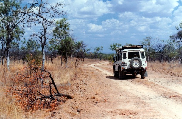
We travelled the Kennedy Highway, through Mareeba, Atherton, Ravenshoe and south, then the Gulf Development Road west to Mt Surprise.

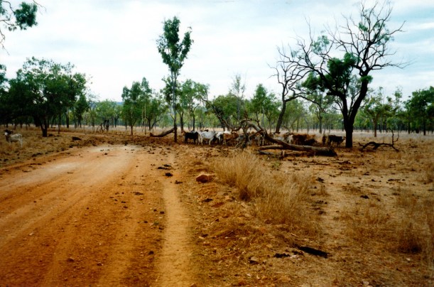
The farming and grazing country of the Tablelands is so pretty, though what we travelled through today was not as spectacularly so as the south eastern parts we’d seen on our earlier day trip up here. The way was hillier than I’d expected, south of Atherton. There were some patches of rainforest still, but we moved more into the savanna woodland type of country as we went.

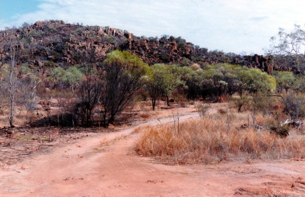
Crossed what seemed to be a mini range between Ravenshoe and Mount Garnet – the last of the Great Divide, I guess.

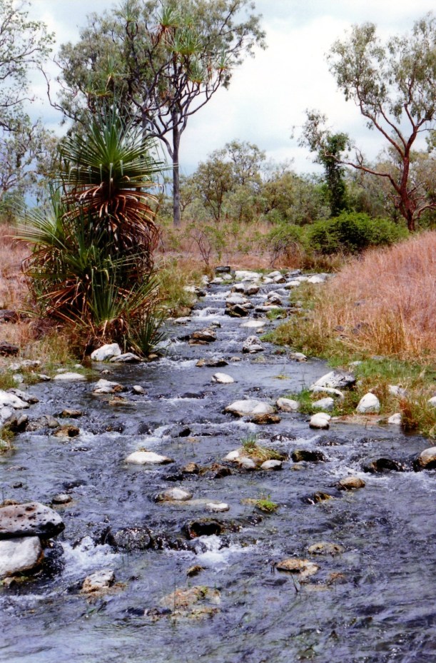
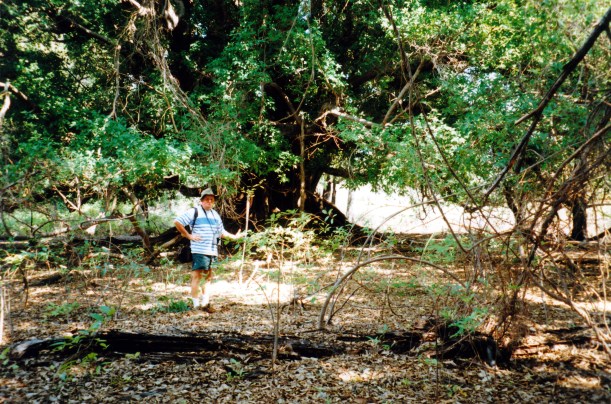
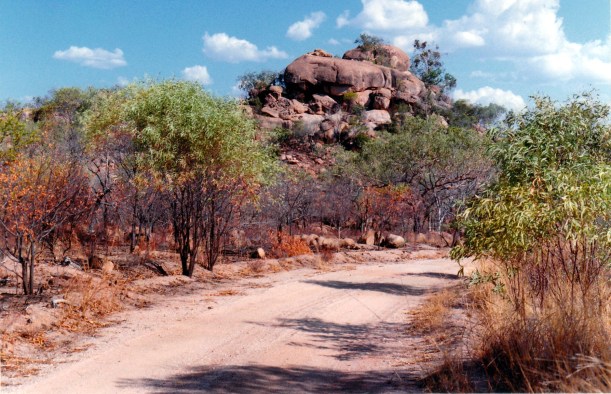
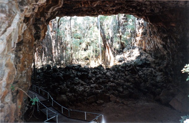
We lunched just out of Ravenshoe, at the Millstream Falls National Park. We took a short side track from the highway to reach the parking area. From here we walked down to the falls and along the Millstream Creek a little. There were plenty of birds along the way and, of course, we’d left the binoculars and bird books back in Truck. The track to the falls, which had some stairs too, was about 350 metres each way, which was enough in the heat. The Millstream Falls are supposed to be the widest single drop falls in Australia – but they did not seem particularly wide to us. Maybe when they are in full flood? Anyway, it was a very pleasant spot, and a pretty valley.

10-06-1998 Millstream Falls.jpg

Millstream Falls

10-06-1998 the Millstream near Ravenshoe.jpg

Cooling off in the Millstream Creek

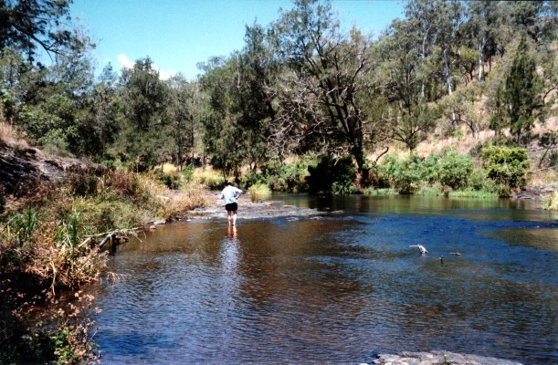
As we continued on the main highway, noticed some side tracks going off towards the Millstream. If one was camped around there, they could be worth exploring.

We had planned to stop and look at the Innot Hot Springs, and maybe stay a night there, but they were shut.

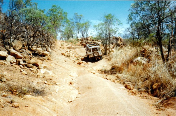
By the early afternoon, the travel was rather hot and dry – we were well into the dry grass and woodland country now. The road was sealed, but often just a single width strip of bitumen, and John had to pull off onto the shoulder to let oncoming traffic past.

Passed through Mt Garnet township – small – but didn’t stop.

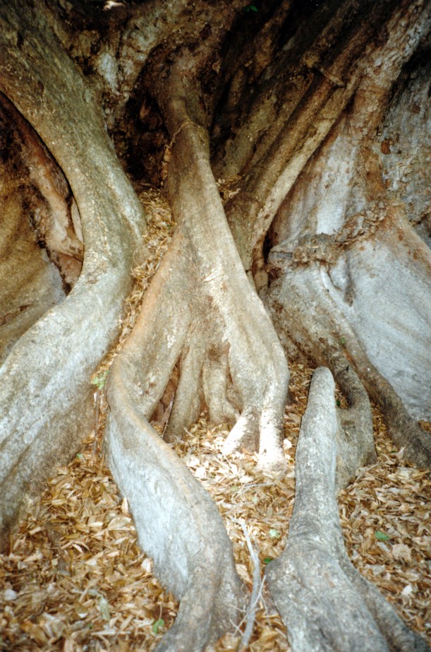
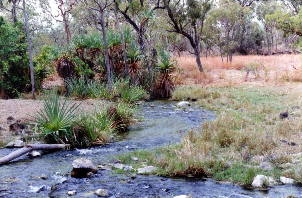
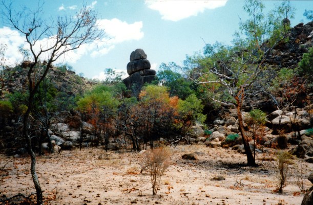
We took a drink break at the Forty Mile Scrub National Park – just in a gravelled pull-over section beside the road. Some remnant dry rainforest and semi evergreen vine thicket is preserved in this park. The latter is an ancient type of vegetation, similar to other ancient remanants in Asia and Africa. There was a short walk track we could take from the parking area, but it did not look all that attractive and we couldn’t be bothered. There is a pleasant, new-ish, picnic area there, with composting toilets, tables, seats and shelters. It could even be an overnight stop, for those so inclined, though it is right by the highway.

Just south of Forty Mile Scrub, turned off the highway, to the west. We intended to stay at Mt Surprise, rather than at Undara. I’d heard somewhere that the camp area at Undara was not very pleasant, being rough, dusty and overpriced. As we came into Mt Surprise township, saw an eye catching and different sign for a Bedrock Village Caravan Park, so turned right to go have a look.

10-06-1998-bedrock-village

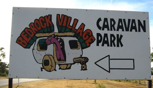
A different sort of sign

It is a new park, only opened this year, developed by a young couple, Jo and Joe, who have two young children. Jo is originally from Bendigo. In the course of our finding out about the place, and deciding to check in, John did much talking with Jo about computer matters. She is interested to see what our scanner does. She is a part time admin assistant at the local school, which has eight students, from three families! As the nearest proper commercial centre is Atherton, there are some challenges involved in business activities out here.

The park is open and hot; there is not much shade yet, although lots of trees have been planted in strip beds that divide the sites. We booked in for a week, anyway, to use this as a base to explore the area. The park also has a very nice looking, new, inground pool. The amenities are in a pre-fab donga type building – adequate but not fancy.

We were charged $14 a night, with the seventh night free. Still under our budget.

Setting up camp was a hot exercise. I thought Cairns was hot, but there is a big increase in heat away from the coast!

The park will be lovely when the trees and shrubs have grown up. We really like the concept of one rig per pull through bay – saves a lot of backing issues, for starters!

There are hardly any other guests here. The tourist season is definitely over. Jo told us that tourist places further west, like in Karumba, would be mostly shut down now. We had begun to wonder about that, after seeing the Innot Hot Springs closed. Guess we may have to revise our plans.

We collected information about Undara and its tours from Joe, who used to be a Savanna Guide there.

Tea was the last of the corn soup, then fettucine with my best pasta sauce.

We sat outside at dusk, putting on insect deterrent because there were some mozzies – that surprised me! Looked at a superb sunset in the west and then a lovely moonrise in the east.

John found he can only get one TV channel – 10 – and that is not very good quality. Fine by me!

John got out the scanner and scanned the map of the Cape to use in a letter he is writing.

It was a hot evening, so we turned the air-con on for a while. However, the night cooled down enough for us to sleep comfortably.

It is wonderful to be away from urban Cairns and out in the bush again. It is so quiet.

10-06-1998-cairns-to-mt-surprise

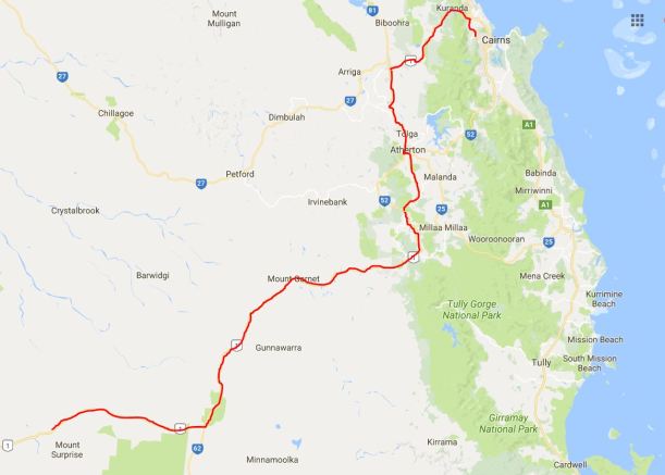
Cairns to Mt Surprise, via the Atherton Tablelands